
FORWARD to Post-war Ordnance Survey of Great Britain standard designs
Reference numbers in square brackets and artists' initials are explained here A black drawing on a thick brown paper book-fold cover is a generic feature of most of these maps. Post-war versions are usually on cream card
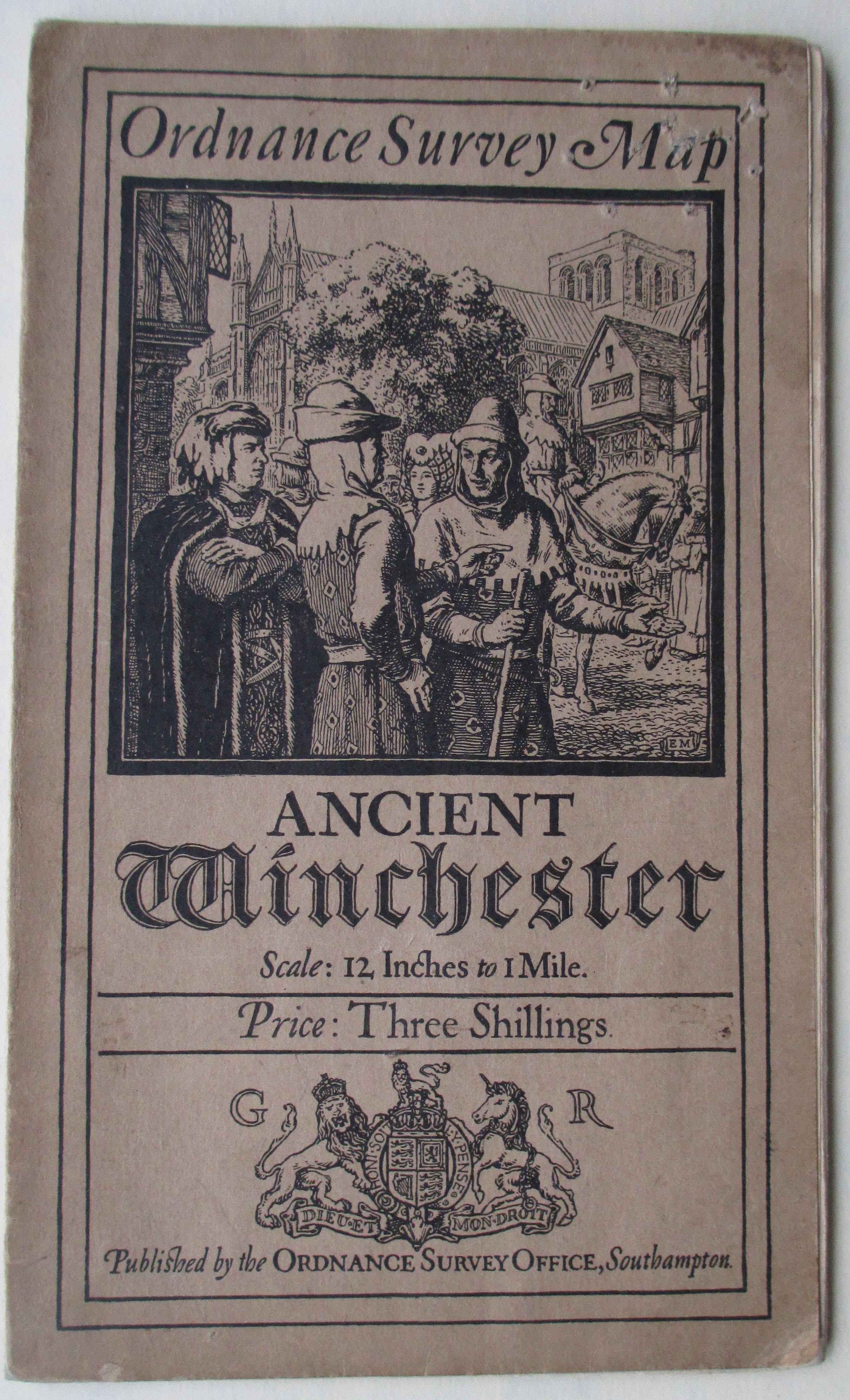
83 Mediaeval Winchester scene EM Ancient Winchester: the Celtic Caer Gwent and Roman Venta Belgarum, 1920
- [a] 113x193mm. Adhesive. "Three Shillings".
- [b] 111x192mm. Adhesive. "Four Shillings"

84 Roman mosaic EM Roman Britain, 1924/1928&/1956 [coloured]/1978 [published 1979; coloured]
- [a] 152x221mm Bookfold First edition. 1924.(No printcode) Paper map, Folkestone mis-represented, no CCR. Another copy on cloth with CCR. (See Hellyer, Sheetlines 32.p18 & 34.p33)
- [b] 1000/26. Cloth map.
- [c] 5000/31. Second Edition.
- [d] 155x225mm 239.3432. Letterpress 5-52 Printed on cream card.


- [e] 212x278mm Bookfold April 1956. Third Edition. Unlaminated. EM deleted.
- [f] 207x273mm Laminated.
- [g] 215x304mm Hardback A 1978 Fourth Edition. Note scale change.
- [h] EM restored
. 


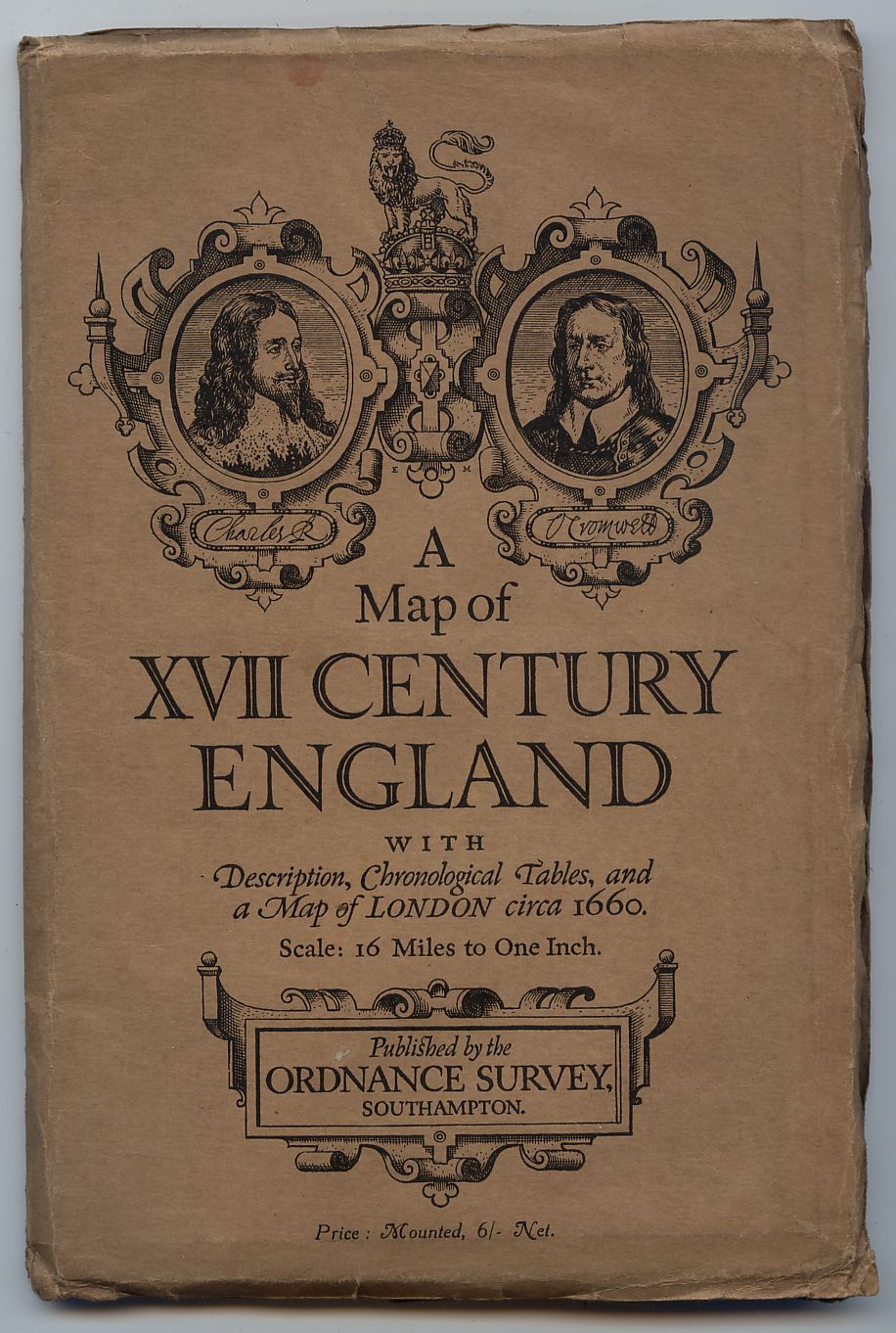
85 Charles I and Cromwell EM XVII Century England, 1930
- [a] 148x217mm Bookfold 5000/30. "net."
- [b] Italic "Net"
- [c] Upper case Price statement.


Chevron and zigzag border EM Megalithic survey of England & Wales
86 1 Stonehenge EM Neolithic Wessex, 1932/1933. The drawing appeared c.1925
[a] 148x216mm Bookfold First edition. 1000/32.
[b] Second edition. 1000/33.
[c] GR no printcode.
[d] ER 1,000 2-36


87 2 Long barrow EM The Trent Basin Showing the distribution of Long Barrows, Megaliths and Habitation-sites, 1933
148x217mm Bookfold 1,000/33.

88 3 Gors Fawr stone circle and Presely Mountains [unknown artist] South Wales Showing the distribution of Long Barrows and Megaliths, 1936. Based on a photograph in An Inventory of the Ancient Monuments in Wales...: Vol. 7 Pembrokeshire [London, 1925, opposite p.243]
146x217mm Bookfold 1036

89 Ox ploughing EM Celtic Earthworks of Salisbury Plain based on Air Photographs. Only one of six sheets published: Old Sarum, 1933 [published 1934]/1937
- [a] 148x222mm Bookfold 500/33. "NET" .(Paper map PRICE TWO SHILLINGS & THREEPENCE NET)
- [b] 148x217mm No "NET" Cloth map.


90 Statue of Augustus EM Tabula Imperii Romani sheets, 1940-1969. The drawing was made in 1934
- 187x255mm Bookfold 1954 (See Hellyer Sheetlines 20.p10)

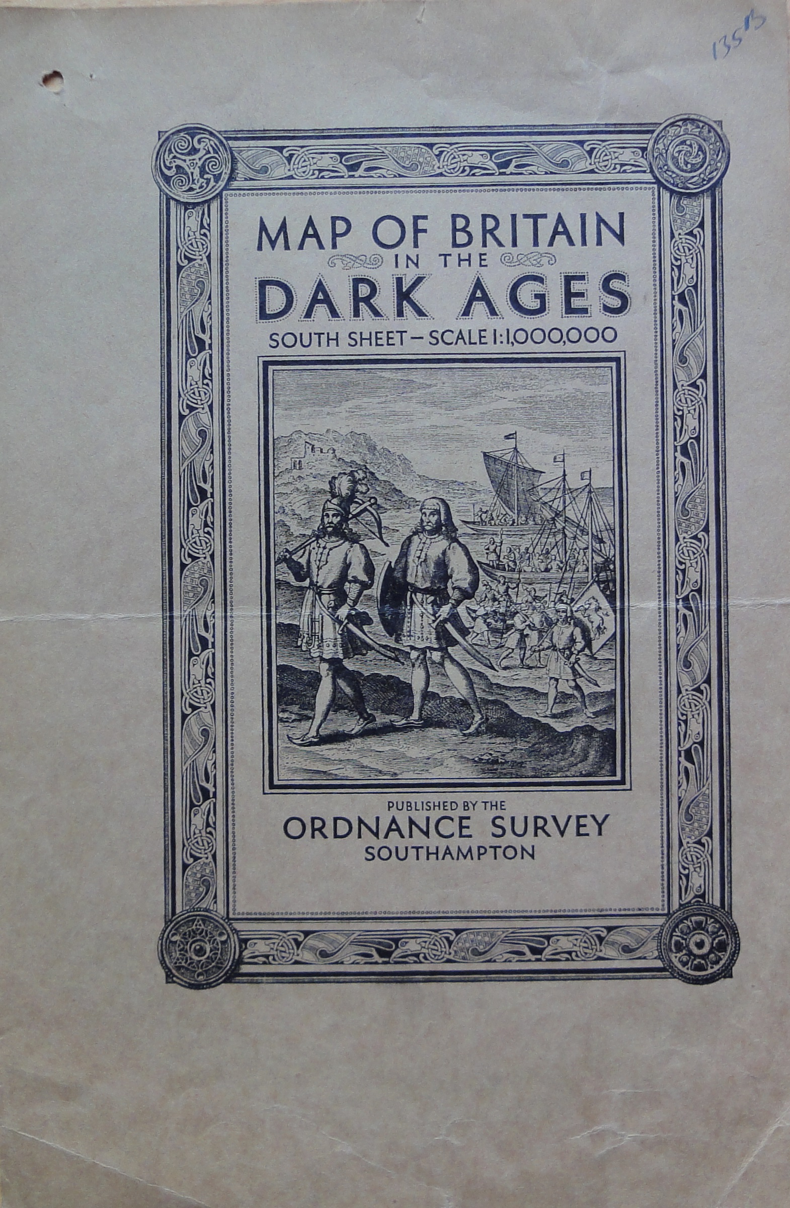
Lindisfarne bird border EM Britain in the Dark Ages (South Sheet), 1935
91 1 Roman fort and Saxons The published design based on a drawing in a ninth century Utrecht Psalter [7]
[a] 145mmx225mm Bookfold 2035.3035. Course buff paper. 3263 letterpress 1600 1-39 printed on thinner smooth light buff paper.
[b] 152x223mm Bookfold 3263 letterpress 3,000 1051 Printed on cream card.
[c] South sheet source drawing


92 2 “The Arryval of the First Anceters” Unused design reproduced from Richard Verstegan "A Restitution of Decayed Intelligence ..." [Antwerp, 1605]
[a] Unused design
[b] Proof.

93 Invergowrie grave-slab RAJ Britain in the Dark Ages (North Sheet), 1938 [published 1939][7]
- [a] 153x218mm Bookfold 3000/38. Course buff paper. 3366 letterpress 1,850. 1/49 printed on thinner smooth light buff paper.
- [b] 154x225mm Bookfold 3366 letterpress 1,850. 1/49 Printed on cream card.


94 Turf wall and Trimontium RAJ Scotland in Roman Times, 1940; cover title The Forth Clyde and Tay: Roman Period. The wall and turret taken from a model by William Bulmer
147x214mm Bookfold 2536. Overprinted 1939 (See Archer, Sheetlines 107.p8)

95 Fort and wall building YM The Border (Roman Period); map not published. A scraper-board design inspired by scenes on Trajan’s Column as depicted in Conrad Cichorius Die Reliefs der Traianssaüle [Berlin, 1896, plates 15 and 46]

FORWARD to Post-war Ordnance Survey of Great Britain standard designs