
Reference numbers in square brackets and artists' initials are explained here
Photographs were introduced to map covers in 1978 on 1:250,000 Routemaster Series sheets published to replace the Quarter-inch Fifth Series. Since then, photograph covers have been applied to Routeplanner Maps, Holiday/Touring Maps & Guides, Tourist, Landranger, Outdoor Leisure, and 1:10,000 Town, City and District Maps, as well as special maps such as Maritime England, 1982, the M25 & London Map, 1986, and some Period Maps. The other current cover convention is to employ coloured location maps. These appear on the 1:25,000 Pathfinder Series, other City Link Maps, and have experimentally been used on some of the 1:50,000 Landranger Series maps beginning with sheet 103
Ordnance Survey undertakes commissions for standard maps, perhaps overprinted, inside special covers. These have not been listed here, but an example is the yellow AA cover applied to the 1965-1967 editions of the Route Planning Map. Its work has also been published in the covers of other agencies, and a few examples are given here:
188 “Bridges’ Patent Mounting” ? Stanford covers applied to One-inch Popular Edition series sheets / Tourist / [at least four variants] District maps, Half-inch layered/MOT/Quarter-inch series sheets
- [a] 96x190mm 6500/32.
- [b] 94x179mm 1923.
- [c] 97x175mm (See 270) 1923
- [d] 90x186mm 1/2" layered map 9-22


- [e] 94x188mm 1923.
- [f] See 11.2.c [a]
- [g] 94x185mm. Emarginate
. 


189 Index map of Great Britain ? Automobile Association and Royal Aero Club General Flying Map [First with AA logo Series], 1929/Second Series, 1934 – Quarter-inch Civil Air Editions
- [a] 133x254 Hinged hardback (The sheet numbers are printed separately and glued) MV (1930-31). These maps are constructed using OS Civil Aviation maps cut and pasted together to form the new sheetlines. In this example the layering is brown.
- [b] Heading altered. 133x254 Hinged hardback MV 1934-5. Brown layering.
- [c] Second Series. 130x255 Hinged hardback (Sheet 5 is recorded with adhesive cover) MV 1938 This example has purple layers, but brown layered sheets are also recorded.
- [d] 102x175mm. No date, magnetic variation 1936/7 strip map format three flight plans Hatfield to Mousehold (Norwich) Mousehold to Tollerton (Nottingham) Tollerton to Whitchurch (Bristol) Scale ¼” to 1 mile


190 Oxford viewed from Hinksey ? Oxford and District Footpaths, Bridlepaths, and Commons Preservation Society
190.1 Black on brown Two-inch map, 1933
110x224mm Hinged 2000/33,1000/36.

190.2 Black on olive Two-inch map, 1945 [17]
115x233mm Hinged 2000/45 ""Geographia"Ltd." replaces "Ordnance Survey 1933." in bottom right margin of map.

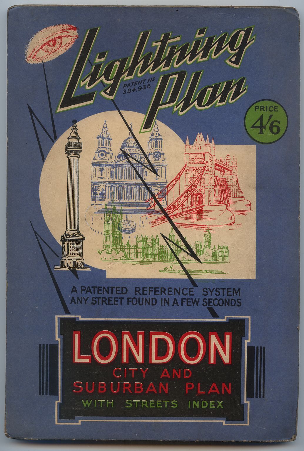
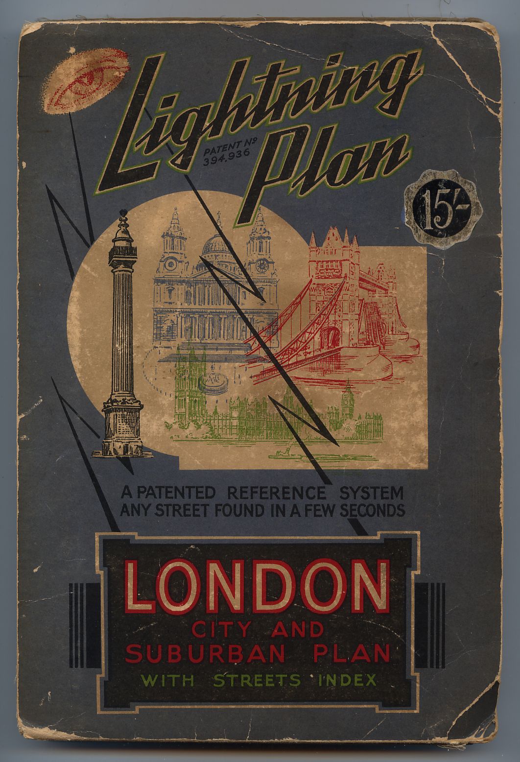
191 London landmarks ? London Lightning Plan [“3-inch” Map of London, 1933, in strip format], 1934
- [a] 168x248mm Hinged 25,000/34. (See Hellyer, Sheetlines 105.p7)
- [b] 168x248mm Price altered by metallic label for dissected map.
- [c] 173x251mm 25,000/34. Hardback edition.

192 University/town arms ? Cambridge and District Footpaths Map [Two-inch map], 1936/?1945 [17]
120x228mm Hinged 2050/36.

193 Geologists inland [1] KTK Geological Survey Maps
1 Squared border, brown “One-inch” England & Wales/?Scotland series sheets, c.1937 [17]
- [a] In "LIST OF MEMOIRS,MAPS,SECTIONS, &c." Geological survey 1937, p.31 :- "Arrangements are being made for certain Geological Survey maps to be placed on sale in folded form." (in covers?) 133x195mm Note "Price 3/6" but no Title/Sheet number. Re-used as OS.434 2000 4-47
- [b] 122x198mm Hinged (Standard size) "ENGLAND & WALES" Series. 1000/29.
- [c] "SCOTLAND" Series. 1000/30.
- [d] "SCOTLAND" District. 1923.
![]()


194 Geologists near coast [1] KTK Geological Survey Maps. See No 96
194.1 Squared border, green “Quarter-inch” England & Wales/?Scotland series sheets, c.1937 [17]
See note at 193.
[a]116x192mm Hinged "ENGLAND & WALES" 1000/37.
[b]"SCOTLAND" 1907

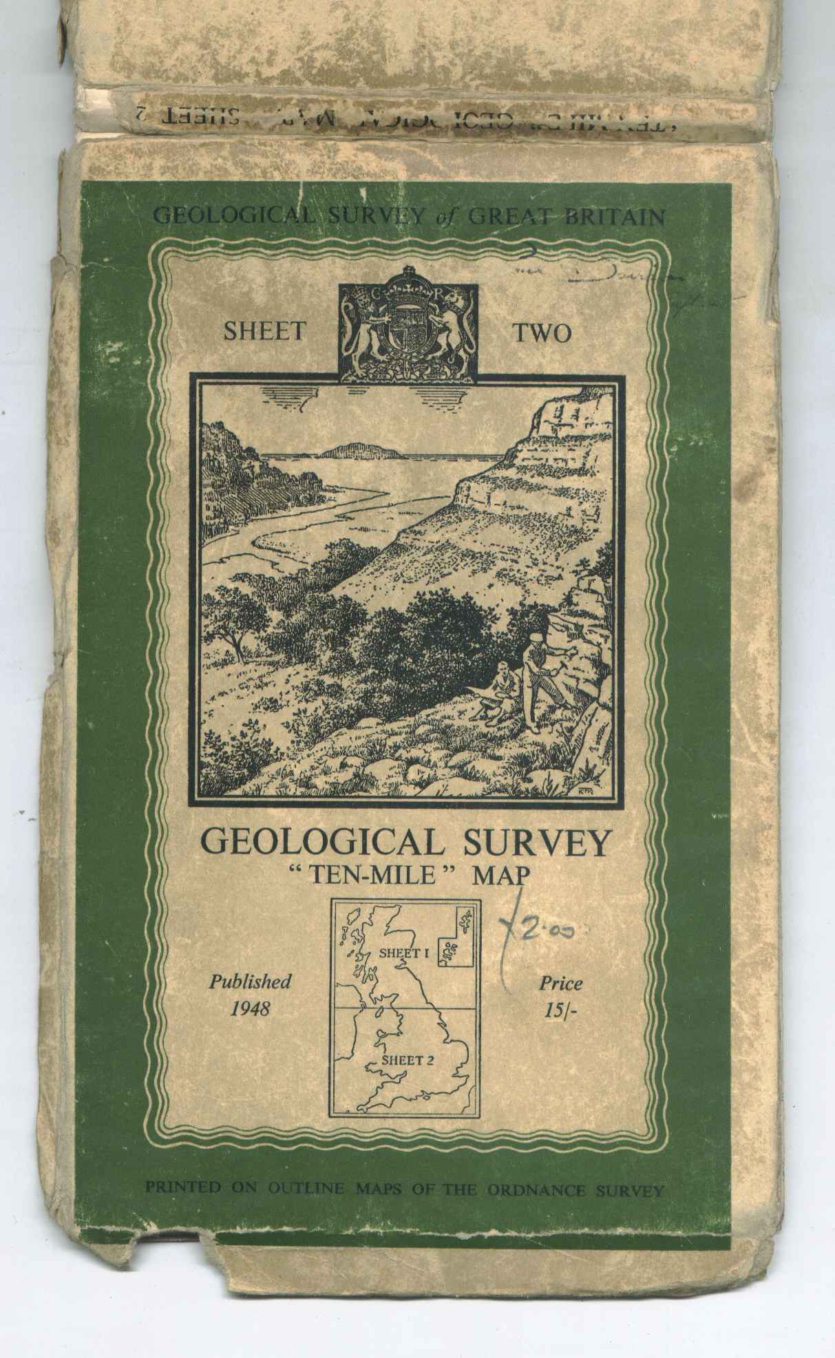
194.2 Wavy border, olive “Ten-Mile” Map of Great Britain, 1948/1957/1964 [11]
[a] 139x213mm Un-laminated Spine title right/left. "SHEET ONE" 2,500/12/47.
[b] "SHEET TWO" 2500/48.
[c] 126x213mm Laminated. Spine title left/right. "SHEET ONE" 12,500/66
[d] "SHEET TWO" 15,000/66 Also Price 17/-


194.3 Wavy border, magenta “Ten-Mile” Map of Great Britain, 1964 [11] . With index overprint
[a] 128x213mm Un-laminated Magenta lines high-lighting black spine title. 6,000/64.
[b] 126x213mm Laminated. Magenta spine title. "SHEET ONE" 18680/74
[c] "SHEET TWO" 15,000/66


195 The arms of the two islands ? 1:50,000 Trinidad and Tobago series sheets, 1926 Trinidad [1:150,000], 1930
- [a] 102x187mm Adhesive. Drawn and printed at the Ordnance Survey, Southampton
- [b] 105x182mm Adhesive. 5000/30.
- [c] Open book 230x185mm GSGS 4424 7,000/5/43.Wa.


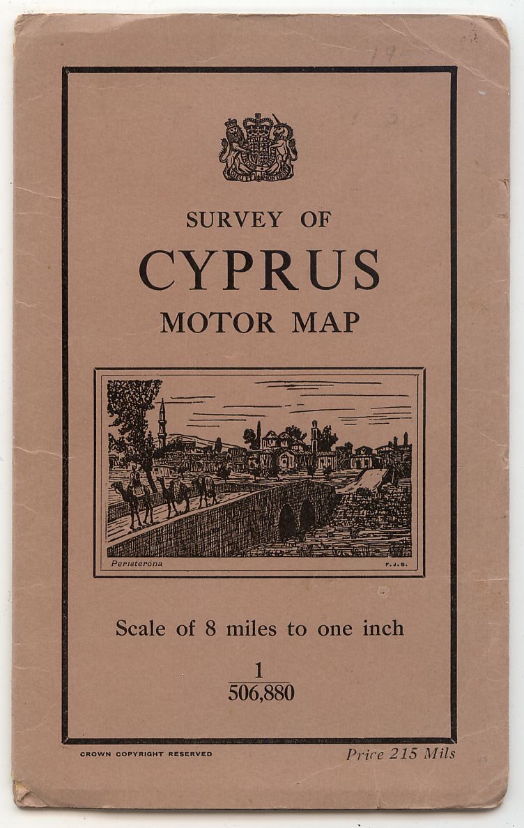
196 Peristerona FJS Eighth-inch Survey of Cyprus Motor Map, 1931 [7]
- [a] 113x187mm. Hinged. No ' v ' in G. Third edition 500/39.
- [b] Unused example of [a] CCR bottom centre.
- [c] 115x190mm. As [a]&[b] but price top right. Fourth edition 1946.
- [d] 115x191mm. Hinged. Smaller arms, CCR bottom left.Fifth edition 1951.
- [e] 119x193mm. Hinged. Arms of GviR. Sixth Edition. Revised in 1953.
- [f] 120x193mm. Hinged. Arms of EiiR. 4260 Seventh Edition 1959.


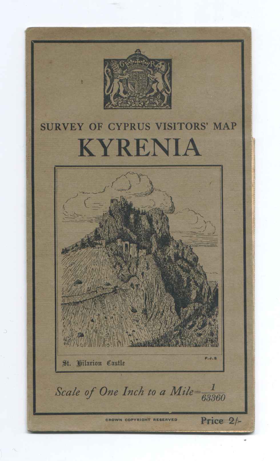
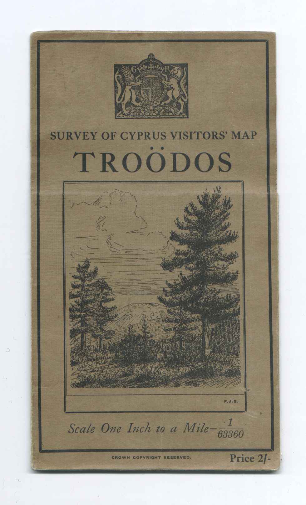
One-inch Survey of Cyprus Visitors’ Maps
197 St Hilarion Castle FJS Kyrenia, 1931
101x180mm Adhesive. Arms of GvR. 450/31.
198 Mountain View [?Troödos] FJS Troödos and the Hill Resorts, 1932
- [a] 101x178mm. Adhesive. Arms of GvR. 500/32.
- [b] Unused example. Smaller arms and G changed to E.

199 Window in St Hilarion Castle FJS Quarter-inch Survey of Cyprus Administration Map, 1932 [7]
- [a] Unused example. Arms adapted for EviiiR.
- [b] 116x204mm. Hinged. Arms of GviR. Second Edition 1950. Revised 1952.
- [c] 116x204mm. Hinged. Arms of EiiR. Second Edition 1950. Revised 1952,1958.


