
Reference numbers in square brackets and artists' initials are explained here
FORWARD TO NEXT SECTION: General purpose One-inch Tourist and District Map designs
9 Four nations’ shields and and foliation, grey [unknown artist] One-inch England & Wales Coloured Edition: Third Edition, Large Sheet Series, c.1916 [17]. ?An experimental cover, recorded only on sheet 126
Open book 196x179mm 7.14 Third LSS. For illustration of the open cover and more detail see Hellyer & Oliver's Guide to Third Edition Maps, published by the CCS, 2004.

10 The Royal Arms with mantling EM One-inch England & Wales/Scotland/Ireland Coloured Editions, 1919 [17]
10.1 Black, red sheet name England & Wales Third Edition, Large Sheet Series sheets/District Maps
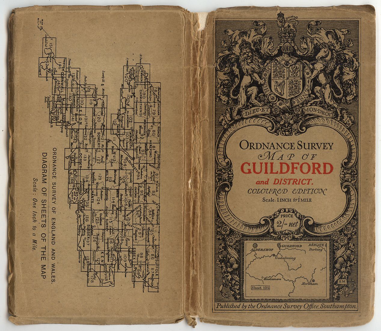
- [a] Open book 207x185mm 10.14. Sheet number in small print under Scale.
- [b] Open book 207x182mm 5.14. Sheet number in small box within the index diagram.
- [c] 93x177mm Adhesive 6.12. The bookfold was discontinued in favour of the adhesive. Rather than discard the already printed book style covers with a list of "principal small scale Maps" printed on the interior, some were cut down for adhesive use. Sheet number in small print under Scale.
- [d] 94x177mm Adhesive 3.12. Sheet number within the index diagram. Standard size for cloth and paper sheets, and design for series sheets (Sheet 34 Liverpool District an oversized map has a cover 111x176mm)
- [e] 107x180mm 1907 Dissected sheet.
-


For full set of 'District' titles see separate page
10.2 Dark red and brown England & Wales Third Edition, Large Sheet Series sheets/District Maps Scotland Third Edition/Ireland series sheets/District Maps
- [a] 107x180 10.12. Dissected map no number in top right corner.
- [b] 106x181mm 1911. Sheet number introduced in border top right.
- [c] 103x176mm 1912. Size of sheet number box within index diagram increased.
- [d & e] 96x177mm 4.20. Different type faces for titles and 3/-
- [f] 97x188mm 2.13. The red border at 181mm is printed just long enough for a standard dissected cover but not quite long enough for this oversize district sheet leaving the exposed buff bands. The price under the label is 2/- as it is on H.10.1 examples, increased to 3/- on later H.10.2covers.


For full set of 'District' titles see separate page
11 Cyclist seated on hillside EM One-inch England & Wales Popular Edition 11.1 Black, red sheet name 11.1.a With location map Series sheets except sheet 140, 1918 [published 1919] District Maps: Aldershot District (North)/(South), 1914
- [a] Open book 208x183mm 1919. Price under lalel is 1/6. Note decorative design to sides of index diagram and size and style of Sheet box within it.
- [b] 96x179mm Adhesive 1919.
[c] 110x176mm Adhesive 1918. An oversized cover for an ovesized map. Sheet 146 has the same large cover an H.11.2a example without sheet number top right is also recorded. Both sheets were later refolded from 8x4 panels to 9x4 in order to fit in standard sized adhesive covers.


For full set of 'District' titles see separate page
11.1.b With placename list Sheet 140, 1919
94x177mm Adhesive 1919. Place name list instead of diagram but note ornamental box around "SHEET 140"

11.1.c Place’s Paper legend Series sheets on Place’s Waterproof Paper, c.1930 [17] [8]
- [a] 112x194mm Hinged 5500/29 O.S.Leaflet No.4935 a list of remaindered Waterproof maps is illustrated in "Sheetlines" 22 p.20 (See also 11.2.a Maps on Place's Waterproof paper [c])
- [b] 109x191mm. Hinged 3000/30. The Weymouth waterproof cover conforming to the standard unlike the ordinary series covers 11.1b/2b.
- [c] 111x192mm. Hinged. 3035. Cover price as remaindered stock 2/6.


![]()
11.1.d With oval price panel ?Unused design for Popular Outline Edition
11.2 Dark red and black
11.2.a With location map Series sheets except sheets 17 and 140, 1919 [17]. See No 76 District Maps: Aldershot District (North)/(South), 1914/1919; York District, 1919; Salisbury Plain, The Aldershot Command, 1920
- [a] 96x178mm Adhesive 1919. No sheet number top right and small Sheet scroll in diagram.
- [b] 95x177mm. Adhesive.1919. Sheet number added top right The price at 1/6 is the same as [a] but the map is now paper not cloth.
- [c] 96x176mm Adhesive 1919. Sheet in diagram in large box.
- [d] 96x178mm Adhesive 1921. Some cover titles differ from the map titles. Sheet 135 is Hastings. See also 295 Labels.
- [e] 111x192mm Hinged 3035 The supply of precut covers for adhesive use were stuck to plain buff cards hinged to the map giving an appearence of a buff border,this border is replicated when the supply was exhausted and the cover design printed direct on the card, this is an example of the latter style. Note also "Popular Edition Price---" is now in smaller type.
- [f] 111x191mm Hinged 2150/34. Both ENGLAND and SCOTLAND sheet numbers top right and in diagram but without box.
- [g] Bookfold.jpg---Open book 224x191mm 2,500/34. The bookfold used only on paper maps.
- [h] Labels produced for or by local stationers are sometimes used to change cover titles. For more examples see 295. This on "Peterborough" 2040.M38.R37


For full set of 'District' titles see separate page
11.2.a Maps on Place’s Waterproof Paper
The first "Popular Edition" maps to be printed on "Place's Paper" were sheets 26,72,83,101,114 & 117 at a price of 3s.6d.. They were available to the public in July 1929. (Hodson "Popular Maps" CCS 1999 .p187). Stock was "Remaindered" at a price of 2/6 in 1935 ( See Appendix 4. Leaflets. 1936).
- [a] 96x177mm. Adhesive. 3500/27. Price 2/6.
- [b] Minor corrections 1924. Price label for 3/6. A mark middle left suggests that a Place's label may have been stuck on as with [c]
- [c] As [b] but 3/6 label removed and two later price amendments.
- [d] 96x176mm. Adhesive. 5500/29. The regular cover is illustrated at 11.1.c [a].


11.2.b With placename list Sheet 140, 1919
- [a] 94x177mm Adhesive 1919. "Sheet 140" in large plane box, see H.11.1b.
- [b] Open book 224x195mm 2,000/33. Paper map.
- [c] 115x199mm Hinged 2036 "Popular Edition Mounted in sections" in italic,and Price after Scale.


11.2.c With Stanford’s addresses Coloured/outline series sheets/District Maps dissected and sold by Stanford
Four changes of address are noted for this cover, they are:-
- Style 1. [a]&[b] 12.13&14. Long Acre W.C.2. To 12/1925
- 2. [c] & [d] Whitehall House etc. added outside and below frame. From 12/1925
- 3. [e],[f] & [g] 29 & 30 Charring Cross S.W.1 added From.1926
- 4. [h] 43 Whitehall S.W.1 replaces 29 & 30 etc.From 1/1931 (Ref. Hodson. Popular Maps. CCS1999 p.277.)
- [a] 108x177mm. Adhesive. Sheet number above Edition note. Price 3/6. 1920.
- [b] 108x207mm. District map. Note the buff border at top. 1925.
- [c] 106x185mm. Sheet number top right. 3000/34.
- [d] 107x186mm. Price label 4/-. 3500/33.
- [e] 106x183mm. Edition and price note deleted. Sheet number central. 5000/26.
- [f] 105x193mm. District map. 5000/28.
- [g] 103x184mm Pamphlet FOREWORD July,1927. Twelve printed pages, the last of which is an advertisement for "Stanford's New Method of map Map Mounting" (see H.88)
- [h] 106x186mm. Edition note and Price 4/- reinstated. Sheet number top right. 3000/34.


11.2.d Black sheet name Series sheets, 1939 [17]
- [a] 110x190mm 3039. The buff border has gone.
- [b] 110x190mm 3039. Title introduced on spine.
- [c] 112x200mm Hinged 3039. Only dissected maps in H.11.2d are hinged, all others are Benderfold


- [d] 118x222mm 4039. The oversize map requires the tall format. Note the sketch is horizontal for a 'portrait' style map.
- [e] 116x214mm 4038. Another long format cover but with standard sketch.


12 Car passing signpost EM Half-inch Layered/Hill-shaded Editions
12.1.a Black, full red title England & Wales series sheets, 1919 [17]. Recorded only with book-fold covers
- [a] Open book 210x184mm 1913
- [b] 92x177mm Adhesive 1914 Another example of a bookfold cover cut down to be used in adhesive style. See H.10.1.Watford. Note also that "Sheet" and "Layers" are in bolder type than the Plymouth cover.


12.1. b Black, red sheet name England & Wales series sheets, 1919 [17] ?Unused design for England & Wales One-inch Popular Edition
- [a] 92x178mm 1914 "Sheet" and "Layers" in same bold type as H.12.1a. London.
- [b] 95x177mm 1913
- [c] 97x175mm. 1908 1.13 with green tree symbols. Note Scale in thin upright print.


12.2.a Green and brown England & Wales/Scotland/Ireland series sheets/District Maps, 1919 [17]
- [a] 96x176mm 1912 No sheet number top right. "Sheet" and "Layers" in small type.
- [b] 98x178mm 1910
- [c] 98x177mm 1910 Sheet number added top right. [d] 111x192mm Hinged Railways revised to April 1914. See note at H.11.2a.
- [d]re. mounting.


- [e] Open book 226x190mm 3500/29. Paper map.
- [f] 110x191mm 2035. Sheet number in un-bordered box top right.
- [g] 110x191mm 2537. GR. Price reduced to 2s.9d.


- [h] 110x191mm 2500/30. ER.
- [i] Open book 224x191mm. 3037. Paper map. ER. Price reduced to 2/-
- [j] 96x177mm.Adhesive. 1912.Ireland, note price alteration by red overprint (see also 6,[i]).
- [k] 108x181mm.Adhesive. 1913. Broad borders for dissected map.


For full set of 'District' titles see separate page
12.2.b Brown sheet name England & Wales/Scotland series sheets, 1939 [17]
- [a] 111x192mm 1910 Old stock in new cover.
- [b] 111x191mm 2038. No H.12.2b.Benderfold has yet been recorded with a title on the spine. Do dissected hinged examples exist?


13 Motor cyclist at signpost EM Quarter-inch Third Edition/Third Edition (New Series)
13.1.a Blue and black England & Wales/Scotland series sheets, 1919 [8] [5]
- [a] 96x176mm Adhesive 7000/25.
- [b] 108x180mm Adhesive 1920.
- [c] 111x194mm Hinged 5200/29. Note "Net"


- [d] 92x177mm Adhesive 1922. Another copy of exactly the same map measures 101x178mm.
- [e] 107x191mm Hinged 1923. Note "Net" Another copy of the same map has an adhesive cover 92x176mm but cover title is "GLASGOW,OBAN and the SOUTHERN ISLANDS" and no "Net".
- [f] 97x210mm


- [g] 177 x 96x117mm. 8000/29. Place's Waterproof Paper. Discernible by Price 4/-

13.1.b Black sheet name England & Wales/Scotland series sheets, c.1932 [17]
- [a] 112x191mm Hinged 5,800/30. Town maps(inside)1933.
- [b] 110x192mm Hinged 6000/32. Another copy "Price Three Shillings Net"
- [c] Open book 228x192mm 500/35.Town maps(inside)1933. Paper map.
- [d] 107x195mm Hinged 2,000/33


13.2 Brown and black District Maps: South Central, 1924; Glasgow and District, 1930 England & Wales series sheet 2A North Central, 1926
- [a] 112x194mm Hinged 5,000/30. The 1928 British Association map revised and put on public sale.
- [b] 97x177mm Adhesive 1926.
- [c] 111x180mm Adhesive 1924. See also H.7.1b. South Central.
- [d] 96x178mm Adhesive 1924.


14 A31 signpost near Hursley AP Ministry of Transport Road Map, 1923. Probably a woodblock design
14.1 Black on orange paper Half-inch England & Wales/Scotland series sheets
- [a] 132x197mm Bookfold 1923. GR.Paper map. Cloth maps "Two Shillings & Six Pence"
- [b] 131x194mm. Bookfold 2550/23. Map title Worcester and Ludlow.
- [c] 132x198mm Bookfold 1000/29. ER.Paper map.
- [d] 132x198mm Bookfold 300/36.Note simplified GR indicating GviR. Map with purple "Class II " roads.
- [e] 132x197mm Bookfold 1923. SCOTLAND. GR. Dissected map.

![]()


14.2 Dark red on orange paper London [Two-inch map]
- 140x195mm Bookfold 1923. Paper map. Cloth maps "Three Shillings"

15 The road ahead by night
EM ?Unused design for Half-inch Ministry of Transport Road Map

16 Scottish lion rampant EM One-inch Scotland Popular Edition
16.1 Thistles, small format Series sheets, 1924
- [a] 108x184mm Adhesive 1926. See also H.11.2a The Cheviot Hills.
- [b] 96x176mm Adhesive Both 2300/28. Different title type faces. With and without "net" ]


16.2 No thistles
16.2.a Long format Series sheets, c.1928 [17]
- [a] 120x272mm Hinged (the hinge115x260mm) 1250/28. Cloth maps "Price 3/-" 114x262mm (the hinge 108x254mm) Sheets known in H.16.2a.covers are 49,52,53,54,55,56,57,58,59,60,61,62,63&64.
- [b] The only fully coloured inside cover?
- [c] Back cover.
- [d] Back.jpg---Inside back cover.


16.2.b Standard format Series sheets, c.1929 [17] [8]. Issues exist with only the superscript wording
- [a] 112x201mm Hinged 1600/31. GR.
- [b] 115x202mm Hinged 1150/28. Paper map. "CLEN"!
- [c] Open book 230x202mm 3000/34. Paper map.


- [d] 115x204mm Hinged 250/28. The front inside cover has the same coloured legend as H.16.2a. and full panel hinges.
- [e] 118x202mm Hinged 3600/31. The front inside cover has the same text as H.16.2a. inside back. Standard hinges 15mm.
- [f] 116x206mm Hinged 10/37. ER. "LOCL"
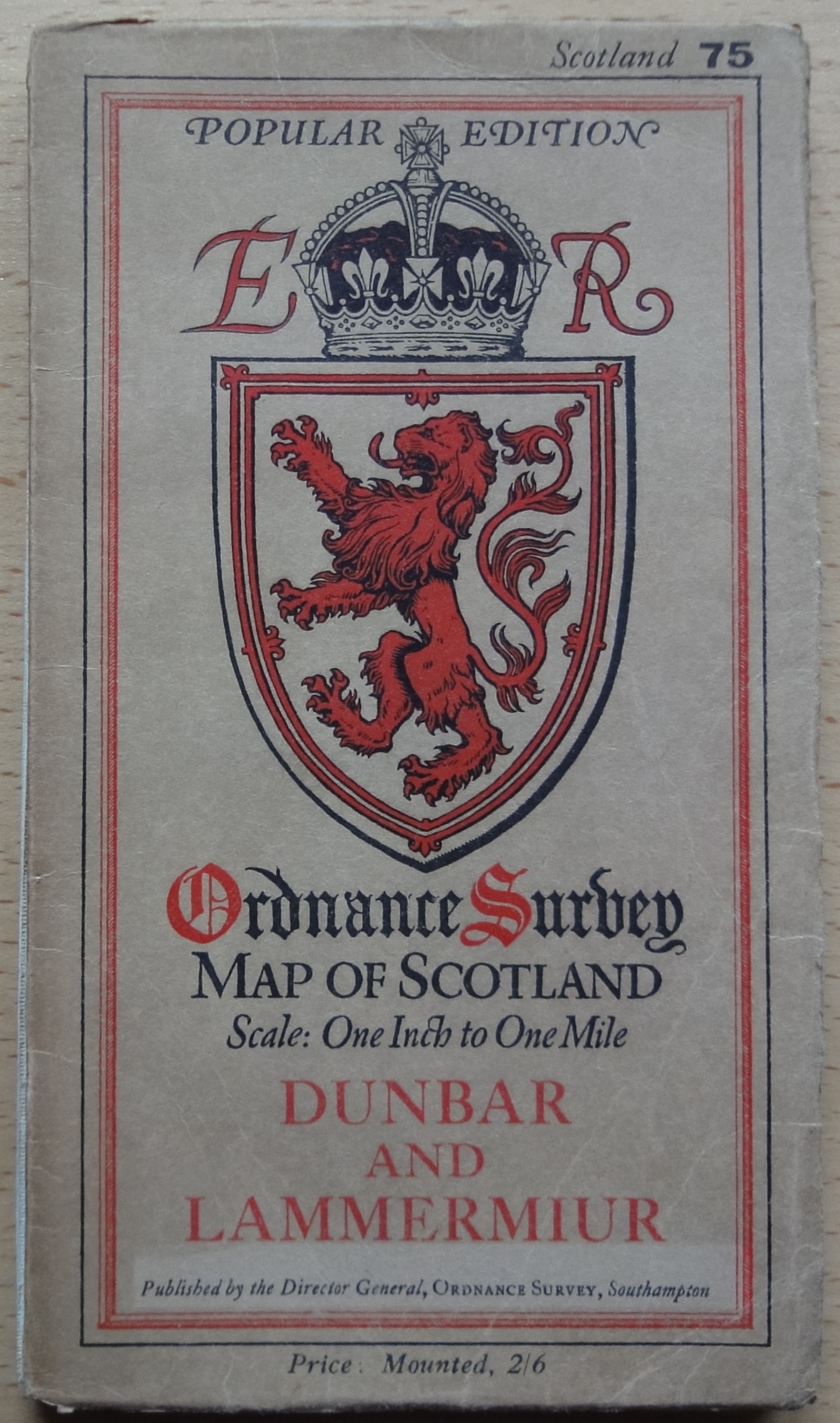
- [g] 113x201mm. Hinged. 2750/27. ER. Incorrect spelling of "Lammermuir".
- [h] Open book 230x202mm 2700/33. Paper map.
- [i] 95x220mm


16.2.c Black sheet name Series sheets, 1939 [17]
- [a] 115x198mm Hinged 2539.
- [b] 114x200mm Hinged 2038. Sheet number top right deleted as on [c]
- [c] 114x196mm Benderfold 2539. It is not known if all Scottish sheets apeared in a black titled cover or how many of those that did carried hinged, Bender' or both styles. Sheet 74 has both.


17 Red Sunbeam at signpost EM Ten Mile Map of Great Britain, 1925 [published 1926]/1936 [published 1937]. An ?unused variant has a border of alternating roses and thistles
- [a] Unused design incorporating thistle and rose border reminiscent of that on 16.1

- [b] 104mmx186mm Adhesive 5000/26.
- [c] 102x186mm Adhesive 7000-26.
- [d] 107x194mm Adhesive 1925. Price on cloth version is "Five shillings Net."
- [e] 117x203mm Hinged 6037.


- [f] 117x204mm Hinged 4038.
- [g] 118x206 Hinged 1539. (Scotland)
- [h] 119x203mm Benderfold 2041.(Also 3039) Title on spine
. 


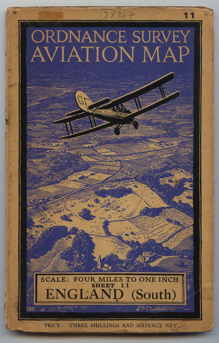
18 De Havilland Hound overland EM Quarter-inch Aviation Map, Civil Air Edition
18.1 Wide format England & Wales/Scotland Third Editions, 1929 [17]
- [a] 130x207mm Adhesive. 2550/30. Brown layers on map.
- [b] 132x206mm Adhesive. 2500/31. Scotland. Brown layers on map.
- [c] 132x207mm Hinged. 2550/30. Brown layers. Price "Net". Also noted as Adhesive with "SHEET" as [a] & [b].
- [d] 133x208mm Hinged. 3000/30. Brown layers. Large "ENGLAND" and small upright "SHEET".


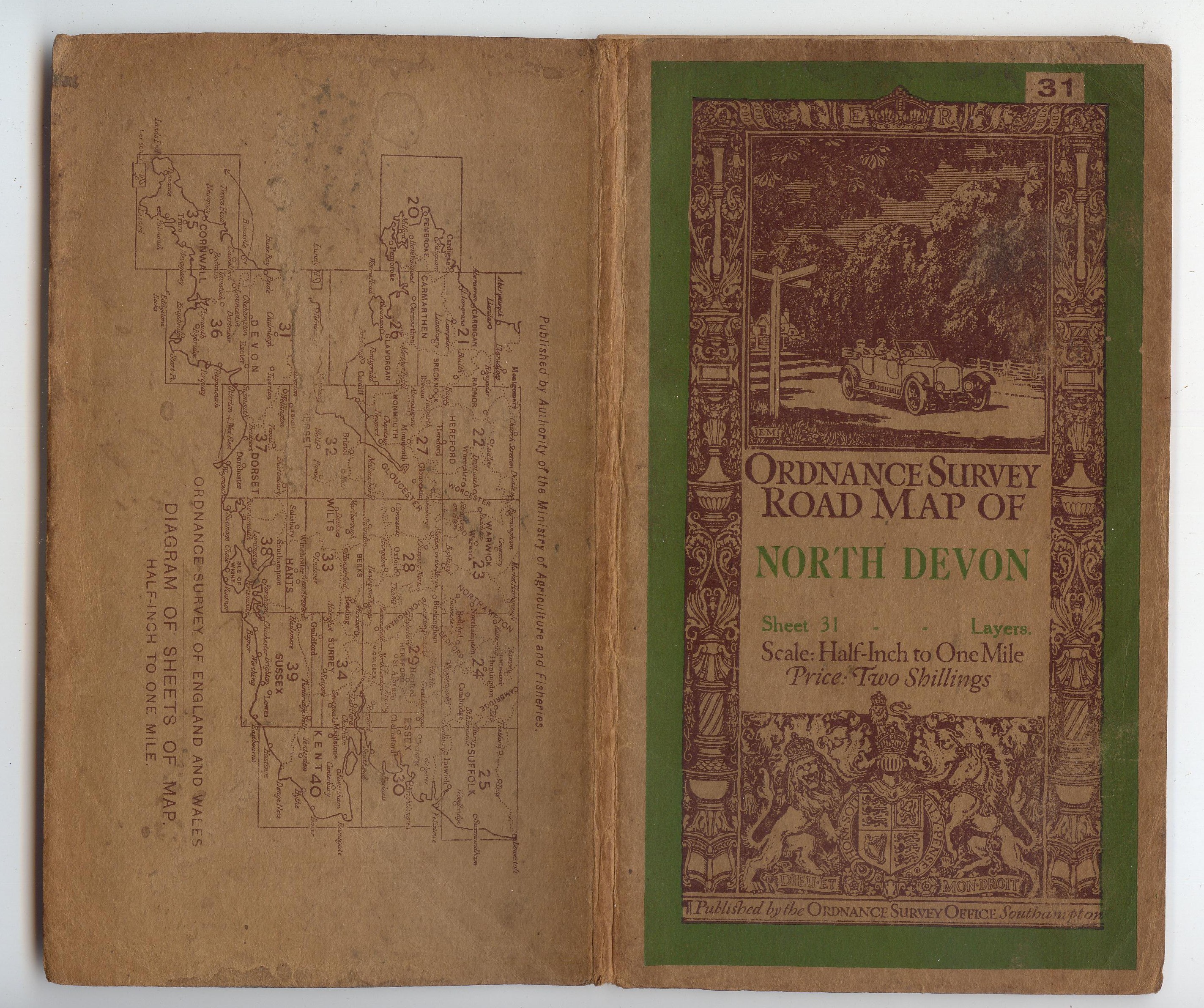
18.2.a Long format England & Wales/Scotland Third Editions, 1934
- [a] 116x265mm Hinged. (Sizes vary for different sheets) AIR INFORMATION CORRECT TO 30-7-37. Purple layers on map. Another copy 3320/34. with brown layers.
- [b] 132x265mm Hinged. (Sizes vary for different sheets) 4170/39. Purple layers on map.
- [c] 125x324mm Hinged. Left image 2050/34. (Brown layers). Price "Net". Right image 6760/38. (Purple layers). Aerodromes on sketch and "Net" deleted.


18.2.b No location maps Scotland Third Edition, 1934
124x237mm Hinged (Sizes vary for different sheets) AIR INFORMATION CORRECT TO 7-6-34.
Only SCOTLAND sheets 2,3,4,5,7&10 recorded. All with brown layers.

19 De Havilland Moth in octagon EM Other Civil Aviation Maps 19.1 Blue octagon Ten Mile Aviation Map 19.1.a Small format Great Britain Special Air Edition (Provisional), 1929*/Air Edition, 1930
- [a] 105x189mm Adhesive 750/29.
- [b] 105x189mm Adhesive 1650/30.
- [c] 105x189mm Adhesive 1650/30.


19.1.b Long format Great Britain Civil Air Edition, 1934
- [a] 114x239mm Proof? Mounted on stiff card. 1934 written on back. Price "Net"
- [b] 132x251mm. 710/31. No sketches and ornate lineation.
- [c] 121x295mm. Hinged 2220/34 (?) Air Information Correct to 25-4-35. GR Location maps added, lineation simplified.
- [d] 122x296mm Hinged 2036. GR . Price not "Net"
- [e] 122x296mm Hinged 1936. ER


- 19.2 Green octagon 1:1,000,000 International Local Aeronautical Map
- [a] NN-31 Amsterdam, 1936 [published 1937]; NM-30 London, NN-30 Edinburgh, 1939
- [b] 130x312mm Proof? Mounted on stiff card 1937 written on back.


19.3 Red octagon 1:500,000 Aviation Map of Great Britain, 1937 [published 1938]. A crown and garter design, intended as the new Ordnance Survey trade mark, reached proof stage, but was not used
- 136x294mm Hinged (Sizes vary for different sheets) 3037.

20 The Royal Arms with mantling surmounting scrollwork EM One-inch England & Wales Fifth (Relief) Edition Series sheets 144, 1931; 137, 145, 1932 Special District (Relief) Maps: Aldershot, North/South, 1932. Aldershot, South cover title Hindhead & District
- [a] 110x196mm Hinged 4000/32. The paper version 108x191mm with consequential narrower cream border.
- [b] 115x198 Hinged 5000/32. The "Linen" version 112x191mm with consequential narrower cream border.
- [c] 114x197mm. 9200/31. Note upright insted of italic sheet number, the style carried forward to 23.
- [d] 108x191mm. Hinged.4400/32.


21 The road ahead by day EM Ten-Mile Road Map of Great Britain showing the Numbers and Classification of the Ministry of Transport, 1932/1935 [published 1937]
- [a] 123x209mm Hinged 800/35. GR no regnal number.
- [b] 125x210mm Hinged 2000/33. GR no regnal number.
- [c] 120x208mm Hinged 1536. ER
- [d] 120x209mm. Hinged. 25/37. ER.
- [e] 120x207mm Hinged 1838. (Scotland) Now GVI but still no regnal number.
- [f] GviR "Scotland" deleted,


22 Black titles on brown card Covers in this section bear no coats of arms (See also 220)
22.1 With location maps Quarter-inch England & Wales/Scotland R.A.F. Editions, 1932 [17] 1:500,000 Great Britain (Aeronautical Map) [cover title Aviation Map of Great Britain] – R.A.F. Edition, 1937/R.A.F. Edition (War), 1940
- [a] 123x255mm Hinged (Sizes vary for different sheets) AIR INFORMATION CORRECT TO APRIL 1932. Brown layers on map.
- [b] 126x298mm Hinged (Sizes vary for different sheets) 10660/39. Purple layers on map. ENGLAND not Wales.
- [c] 113x254mm Hinged AIR INFORMATION CORRECT TO NOTICE TO AIRMEN No. 190 OF 1936. Purple layers on map. Also on-AIR INFORMATION CORRECT TO 24-8-34.Brown layers and 11260/38. Hill shaded, but 117x265mm.
- [d] 117x264mm Hinged 7220/38. Purple layers on map. SHEET 1 is common to both ENGLAND & SCOTLAND hence GREAT BRITAIN.


- [e] 131x265mm Hinged 6000/38. Purple layers on map.
- [f] 113x246mm Hinged AIR INFORMATION CORRECT TO NOTICE TO AIRMEN No. [1937] 34. Purple layers on map.
- [g] 120x296mm Hinged (Widths vary for different sheets) 5239.
- [h] 145x295mm Hinged 7739


- [i] 117x301mm Hinged(Widths vary for different sheets 110-117mm) 4040.

22.2 No location map International Union of Geodesy and Geophysics, Map of Edinburgh, 1936
110x202mm Hinged

22.3 Filigree border [10] EM South Wales and the Border in the Fourteenth Century, 1933
- [a] 117x235mm Hinged 1000/33.
- [b] ditto
- [c]ditto
- [d] ditto
- [e] 147x237mm 23pp Softback,Western Mail & Echo Ltd Cardiff.
- [f] 116x235mm 1000/33. Dissected


22.4 Double lineation
Sheringham District [Six-inch map], 1936. A One-inch map is also reported
- [a] 108x204mm Hinged 500/36.
- [b] Back cover with notice of 1" map.
- [c] Photocopy of 1" map, no details available.


b. 1:1,000,000 Great Britain, 1933
- [a] 112x203 mm. 1933.
- [b] 112x203 mm. 1933
. 
23 Hiker seated on hillside EM One-inch England & Wales Fifth Editions
23.1 Red and black Fifth (Relief) Edition
23.1.a No location map Series sheets/Special District (Relief) Maps, 1933 [17] [8]
- [a] 111x199mm Hinged 5,100/34.
- [b] 109x192mm Hinged 5,100/34. Place's Waterproof Paper
- [c] 109x192mm Hinged 4000/32.
- [d] 107x191mm 4400/32. "Cloth"


23.1.b With location map Series sheets, 1934 [17] [8]
- [a] 107x192mm Hinged 3,500/33. GR. Linen.
- [b] 109x192mm. Hinged. 5500/34. GR.Waterproof Paper, logo inside rear cover
- [c] 110x191mm Hinged 9200/31. ER.Linen
. 


23.2 Blue and black Fifth Edition – coloured, but without relief
23.2.a With location map Series sheets, 1932 [published 1935] Special District Maps: London, 1937; St Albans, 1937 [published 1938]
- [a] 109x192mm Hinged 4536. ER.Linen.
- [b] Open book 225x192mm 4035. ER.Paper
- [c] 109x192mm Hinged 5035. ER.Linen. Labels were supplied to satisfy some local stationers usualy in colours matching the cover design, this one was presumably meant to go on a relief map. See also 11.2.a.[h].


- [d] 112x197mm Hinged 40/37. ER. Dissected.
- [e] 119x199mm Benderfold 5038 GR. Cloth. Title on spine. The only blue titled Benderfold?
- [f] 111x192mm Hinged 4036. GR. Cloth.
- [g] 111x192mm Hinged 5035. GR. Linen
. 


- [h] Open book 230x201 5038. GR. Paper.
- [i] 108x200 Hinged 80/38. GR. Cloth. District (The same map as H.23.2b.).


- [j] Open book 225x192mm. 6036. ER. WRP.(See 'Sheetlines' 112 p40.)
- [k] WRP note on map [j]


23.2.b Black sheet name Series sheets/Special District Maps, 1939 [17]
- [a] 112x194mm Hinged 8039. GR. Only dissected maps with black titles are hinged all others are Benderfold?
- [b] 117x200mm 80/38. GR. Cloth.Title on spine. District (The same map as H.23.2a.)
- [c] 117x200mm 10038. GR. Paper.No (printed) title on spine.Price under location diagram.
- [d] 113x200mm 1036. GR. Cloth. Title on spine.


- [e] 119x193mm 3041. GR. Cloth. No title on spine.
- [f] The same design for another purpose.


24 Roundel view of man in rain EM Maps on Place’s Waterproof Paper [8]
24.1 Red filigree border [10] Quarter-inch England & Wales Third Edition (New Series), c.1933 [17] Glasgow and District [Quarter-inch Special District Map], c.1933 [17]
- [a] 110x196mm Hinged 5000/29 No (New Series) under "Third Edition". W.P. 10
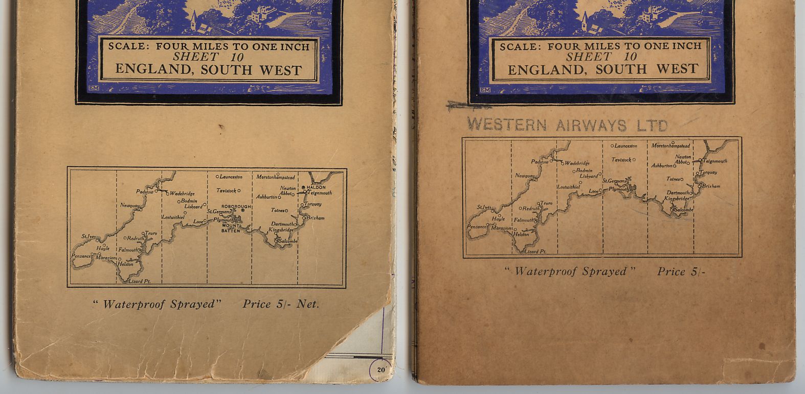
- [b] 112x193mm Hinged 5000/29. "ENGLAND, SOUTH WEST" Cover and map.
- [c] 112x192mm Hinged 6000/31. Now 10 W.P "SOUTH-WEST ENGLAND" Cover "ENGLAND,SOUTH WEST" on map.
- [d] 111x194mm Hinged 5,800/30. ENGLAND & SCOTLAND 1 W.P.
- [e] 111x196mm Hinged 6500/32. W.P.8a (Town plans inside front cover).


24.2 ?Single lineation ?Half-inch Special District (Relief) Maps: Island of Skye, 1932; Birmingham District, 1933 [published 1934]
24.2.a No location map
24.2.b With location map
- [a] 105x202mm Hinged 5050/32. The cover is also recorded on "Manchester District"
- [b] 107x191mm Hinged 9500/31. The red : after Price omitted.
- [c] 190 x 110x190mm. Hinged. 300/30
- [d] 191 x 104x191mm. Hinged. 5500/31


24.3 Double lineation Norfolk Broads [One-inch Special Sheet Popular Edition], 1932
111x202mm. Hinged 4050/32.

25 Country/town scenic strips EM Land Utilisation Survey of Britain, 1933 [17]. On One-inch England & Wales / Scotland Popular Edition sheets. Also published by other agencies
- [a] Ellis Martin Original Artwork external 217x340mm. Internal 143x265mm. Ink on cartridge paper.
- [b] 111x193mm Hinged 1000/34. "England&Wales"
- [c] 109x195mm. Hinged. 1000/34. Lower case placename.
- [d] 113x202mm Hinged 750/33. "SCOTLAND"
- [e] 113x198mm Hinged 1000/38. G.W.Bacon&Co.The maps were printed by various companies for a complete listing see Hellyer,Small-scale Maps, David Archer 1999, p30&53.
- [f] 116x204mm Hinged 7/12/5c. (Library purchase label 21st June 1949) W.&A.K. Johnston Limited.
- [g] 41pp.Paperbck,printed by RICHARD FLINT & CO.E.C.4. The scenic strips are printed in reverse and EM cropped.
- [h] 111x192mm. Greycaine. Undated, but 1935.
- [i] 113x190mm. Waterlow . Undated, but 1935.
- [j] 113x198mm. Martin,Hood & Larkin. Undated, but 1935.


26 Crowd scene, rear view EM Population Map based on the 1931 Census
26.1 Monochrome Great Britain [1:1,000,000], 1934 [17]
- 148x218mm Bookfold 2000/34.

26.2 Red sheet name and frame Population of Greater London [Half-inch map], 1935 [published 1936]
144x219mm Bookfold 1535.

27 Motorist and A51 signpost EM Quarter-inch England & Wales/Scotland Fourth Edition
27.1 Blue and black Series sheets, 1934. England & Wales sheet 9 was first issued with blue panels beside the location map
- [a] 122x311mm Hinged 3035. Town maps 25/35. ER. Panels to sides of location diagram in blue.
- [b] 124x312mm Hinged 1536. Town maps 1935. ER.
- [c] 117x311mm Hinged 8038. Town maps 80/38. GR. Black panels.
- [d] 123x314mm Hinged 2335 Town maps 1.835 GR. "SHEET" in ribbon.
- [e] 122x311mm Hinged ER. 2536 Town maps 1935. GR. 2538 Town maps 1037. "Price" under bottom panel.


27.2 Red and black Series sheets of Military Edition (War Office Edition), 1939 [17]/War Revision, 1940/Second War Revision, 1941
- [a] 124x327mm Hinged G.S.,G.S.No.3957 Air Information Correct To 20.11.39. Town maps 10039. Layered map.
- [b] 123x313mm Hinged G.S.,G.S.No.3957 W.O.15650/40. Town maps 1040. Unlayered map.
- [c] 124x313mm Hinged G.S.,G.S.No.3958 W.O.20000/40.10,000/7/41. Town maps 10039. "War Revision 1940" under bottom panel Layered map.
- [d] 121x312mm Hinged G.S..G.S.No.3958 20000/40. Layered map.


Reference numbers in square brackets and artists' initials are explained here
FORWARD TO NEXT SECTION: General purpose One-inch Tourist and District Map designs