
To advertise on this page contact info@charlesclosesociety.org. To respond to one, contact the advertiser directly via email using the link in the ad. Adverts posted here will have a shelf-life of one year, after which they will be removed, or can be updated as needed.
Updated 10th November 2025
COMPLETE MAP SERIES' FOR SALE. (updated 10th November 2025)
A member has some complete map series for sale, details are below, prices do not include postage. Collection from Bridgwater Somerset is welcomed if practical, otherwise it's the Royal Mail.
| 1. | 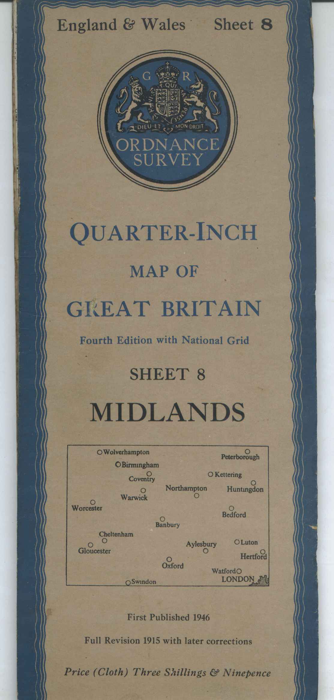 | All 11 sheets of the England & Wales post WWII 4th edition Quarter inch maps in the blue H96 covers. Six maps on cloth, five on paper all in card covers. All in good condition with the odd tear to a cover. £20 ex postage. |
| 2. | 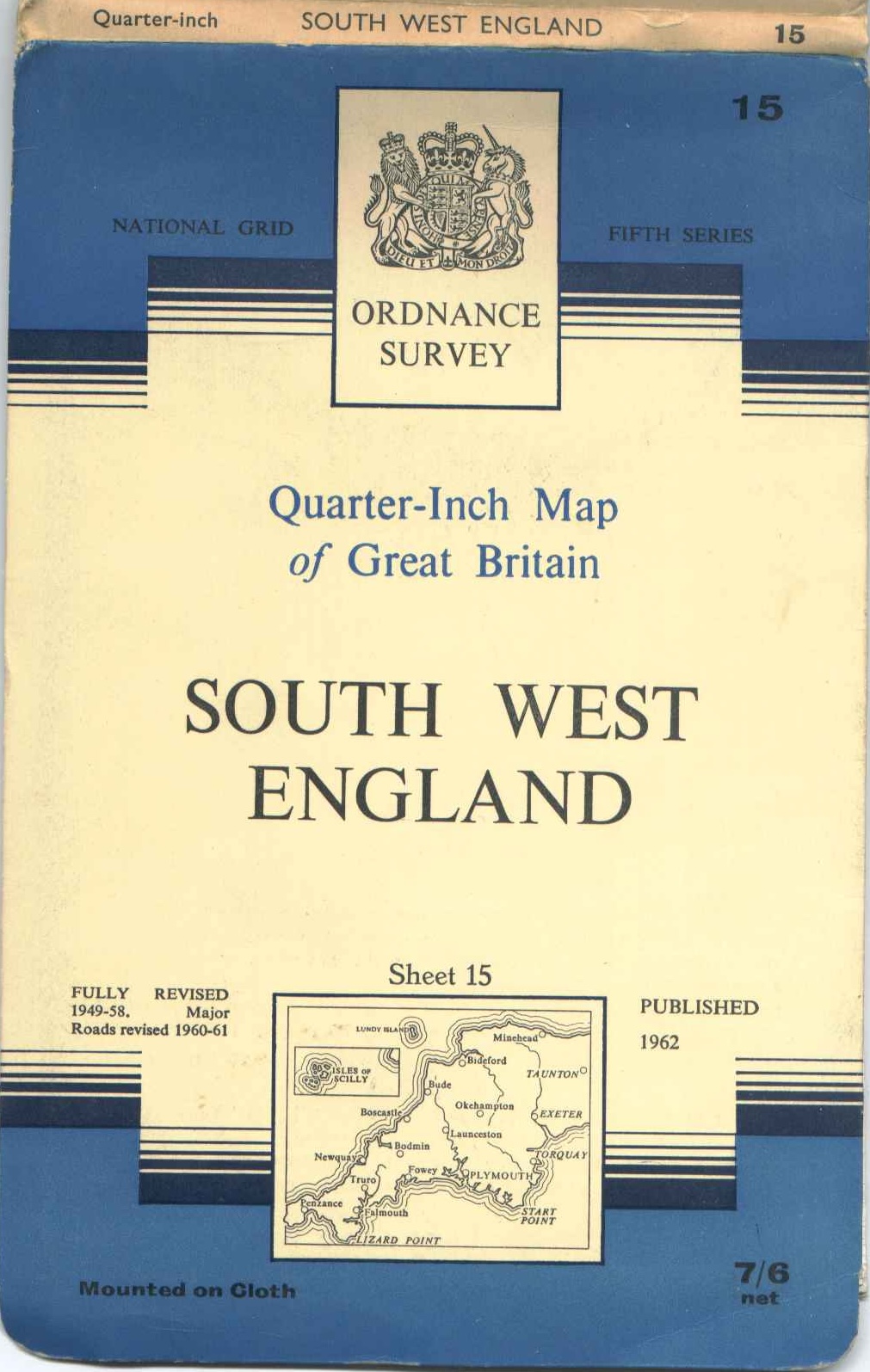 | All 17 sheets of the quarter inch 1:250,000 5th series maps in early blue/white/cream H99.3 benderfold covers. Some maps on cloth, others on paper, all in good condition. £20 ex postage. |
| 3. | 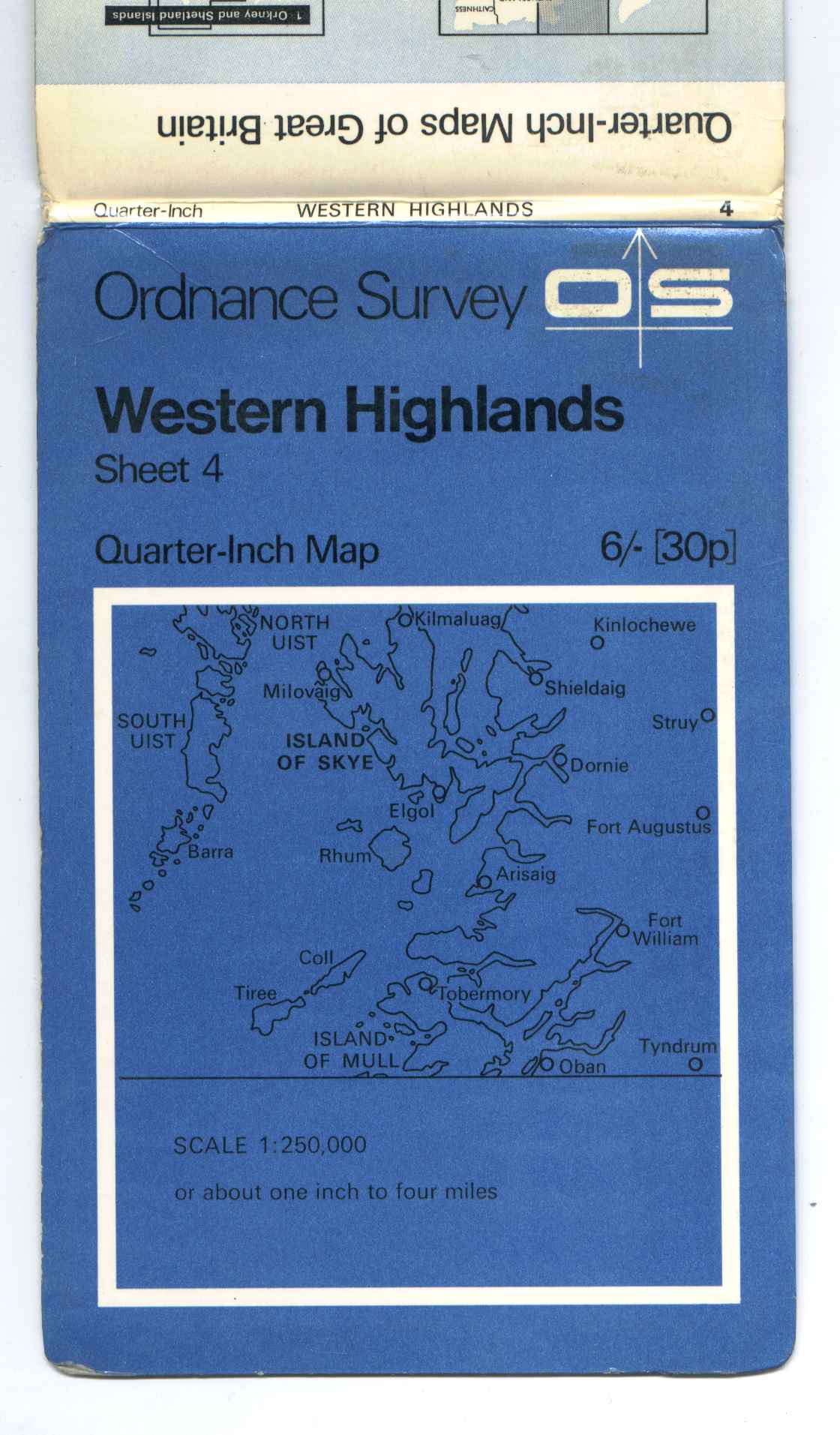 | All 17 sheets of the quarter inch 1:250,000 5th series maps in late all blue H132.2 benderfold covers. All on paper, all in good condition. £20 ex postage. |
| 4. | 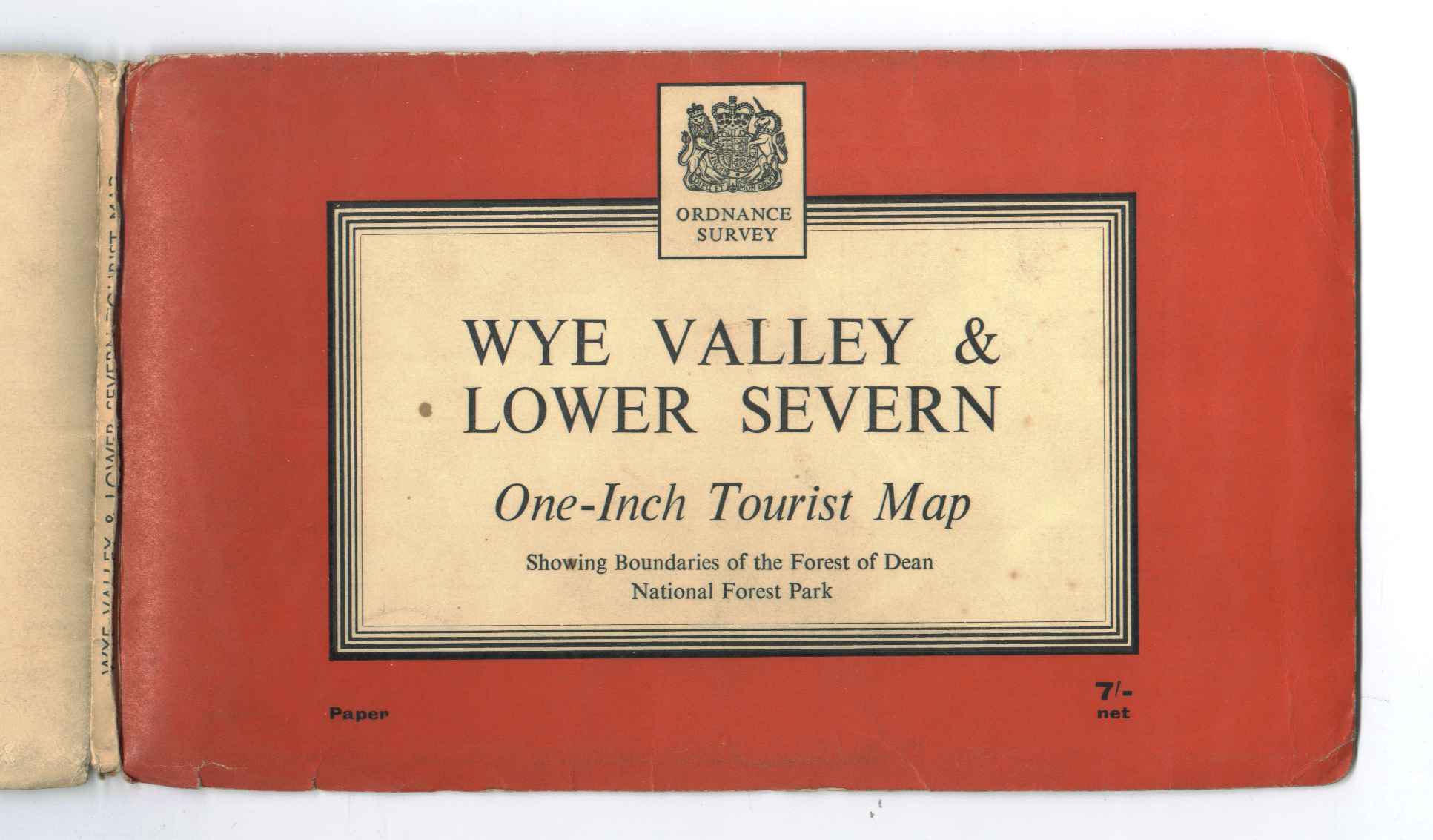 | All 9 Tourist maps from the late 50s and early 60s in red & black line landscape H100 covers. These include the 8 one inch maps and one quarter inch of Wales and the Marches in blue (H100.2). There are two copies of North York Moors, one landscape and one portrait. All maps in good condition. £20 ex postage. |
| 5. | 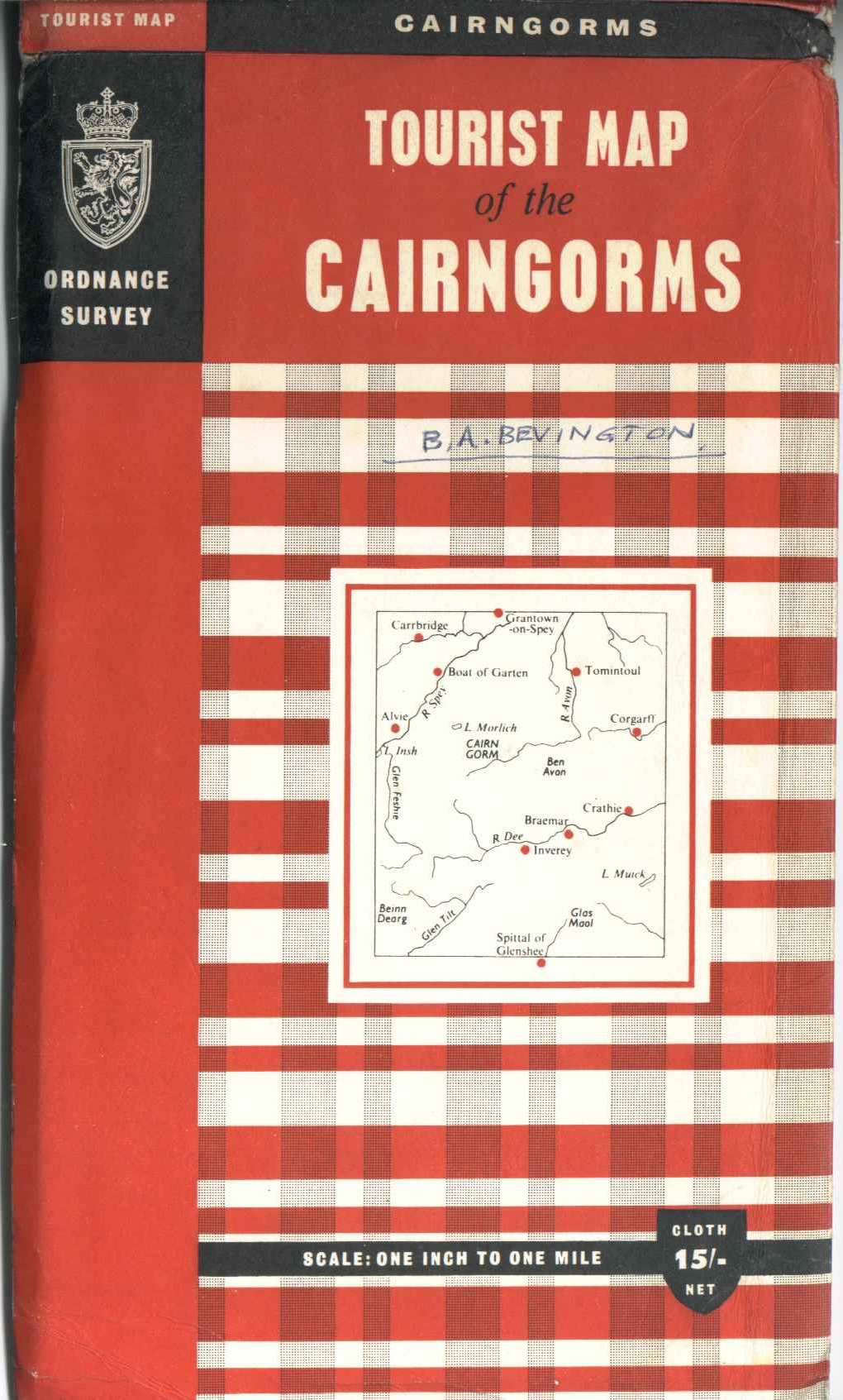 | This set is of 15 Tourist/District/Special maps from the middle 60s. These cover maps H109 to H126, minus H112, H113 and H115. Isles of Scilly (H109) is 1:25,000, Wales and the Marches (H111) is quarter-inch, Snowdonia (H118) is half-inch, Guernsey (H119) is 1:21,120, the rest are one-inch. All on paper in good condition, The Cambridge map (H114) cover has a tear to the cover. £20 ex postage. |
| 6. | 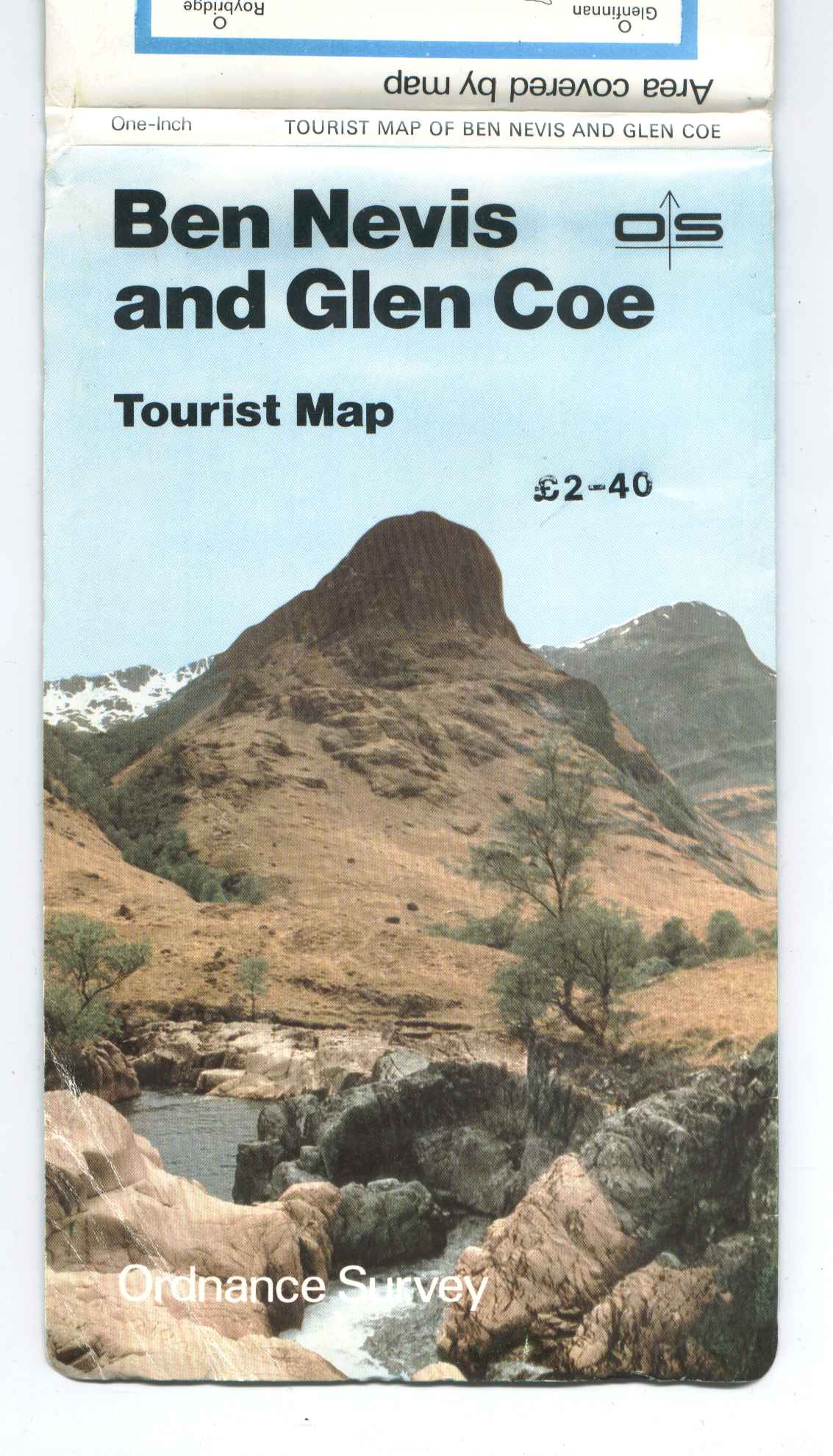 | All 11 Tourist maps from the early 80s in H405 covers. Snowdonia is at half-inch to the mile, The Broads at 1:50,000, all the rest are at one-inch. All on paper with benderfold covers in good condition. £10 ex postage. |
| 7. | 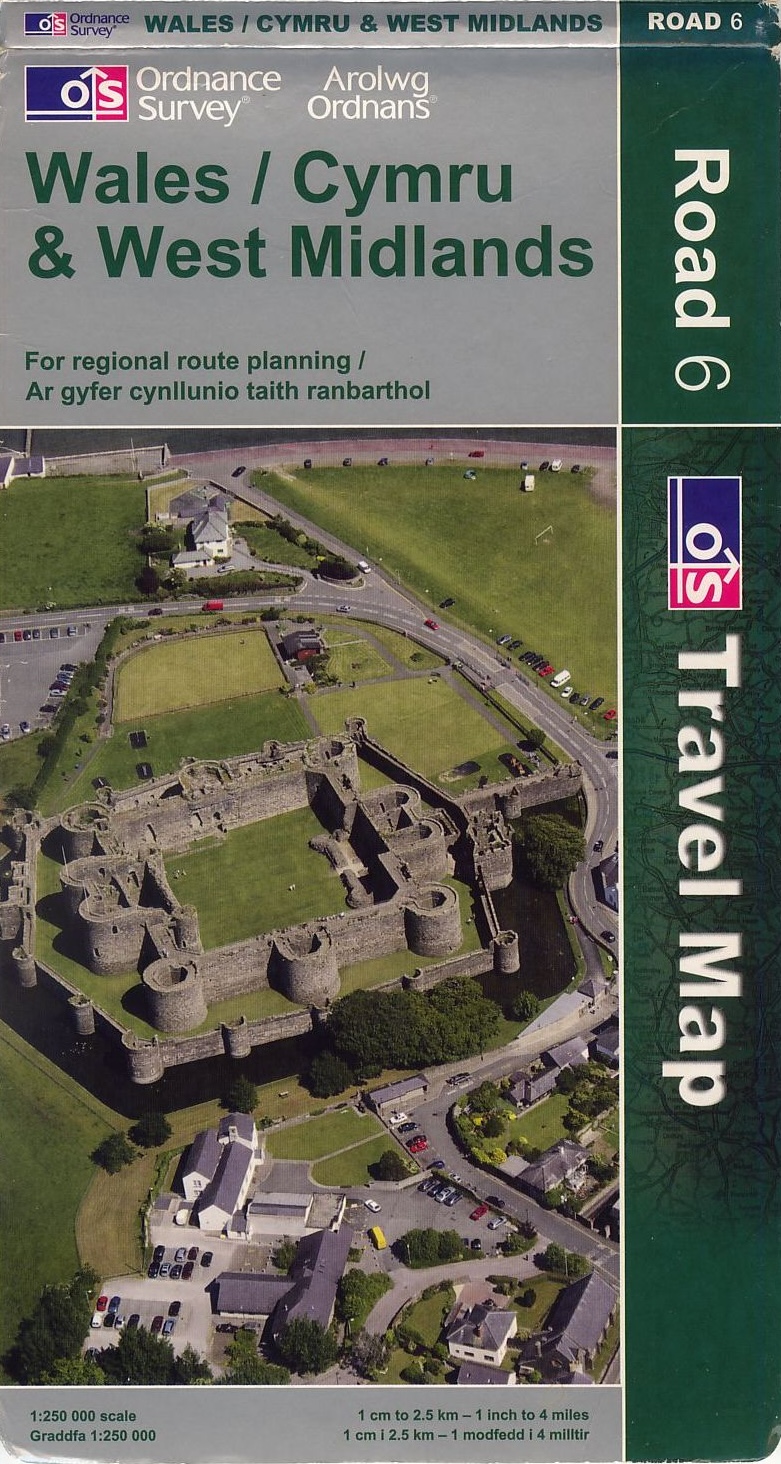 | All 8 sheets of the quarter inch 1:250,000 Road maps in green H442.5 covers, circa 2009. All in good condition. £10 ex postage. |
If you are interested in any of the sets or have any questions, please email Ashley Lawrence and to gain a postage cost or arrange pick-up.
FOR SALE, ONE INCH 7TH SERIES MAPS (added 1st August 2025)
A member has a 167 sheet collection of one inch 7th series maps for sale, which he is open to offers for individuals sheets. Listed for download here, 7 are mounted on cloth, the rest on paper. The member has indicated the year of revision, ignoring the copyright dates, as sheets are often reprinted with minor changes with no revision of the copyright date. He's also indicated the particular edition (by letter) of each sheet, the 'slash' (solidus) symbol represents the triple underline.
If you are interested in any of the maps please contact Andrew Kafel by email directly to discuss prices, conditions and arrangements.
DONATIONS TO SOCIETY FOR DISPOSAL TO MEMBERS (added 27th June 2025)
The items contained in this PDF list for download represent donations from more than one source. Offers should be sent to the Society Secretary by email. The best offer for the individual lots received by 31st July will secure an item.
Items may be collected from Lincoln or, by mutual arrangement, from Cambridge, or at the next AGM. Or they can be dispatched at the cost (and risk) of the purchaser.
By way of guidance on condition, 'vgc' is the state that would be regarded as acceptable for an item bought new.
FREE TO A GOOD HOME (added 27th June 2025)
There is no charge for the items, but there will be for dispatch by courier, unless you can arrange collection from Exeter. Please send expressions of interest to Richard Oliver by email.
Periodicals
- Imago Mundi - complete set, Vol 45 (1993) to Vol 74(2) (2022)
- Cartographic Journal - complete set, Vol 1(1) (1964) to Vol 59(3) (2022)
- Maplines (BCS magazine) - complete set, 1995-2022
- Cartographitti (BCS map curators) - complete set, no. 1, 1983, to no. 97, 2020
- Bulletin of the Society of Cartographers: complete set, up to Vol 31(2) (1997)
Books
- Major C.R. Hart, Mapping by Remote Control with the Aid of Radar, Directorate of Military Survey Air Survey Research Paper no.19, February 1946: with several specimen and comparative maps.
- Ordnance Survey, Projection Tables for the Transverse Mercator Projection of Great Britain, HSO, 1950
FOR SALE, Cassini Historical Maps and Atlases (added 29th April 2025)
A member has a full set of unused Cassini Historical Maps for sale. These comprise:
- 123 sheets of the Old Series, 1805 – 1874.
- 123 sheets of the Revised New Series, 1896 – 1904.
- 124 sheets of the Popular Edition, 1919 – 1926.
These currently retail at £15.99 each making a full set worth over £5,900, he will accept £1,000.
Also, a 2nd edition of 'The Railways of Great Britain, A Historical Atlas' by Colonel Michael H Cobb. This was delivered from Ian Allen with slight damage to the cover, similar copies are selling at £300 on eBay and AbeBooks. He will accept offers over £100.
Also, a copy of the 'Ordnance Survey Atlas of England and Wales' 1922 in fair condition. It has had a repair to the spine, but all maps are linen mounted and in good condition. He will accept sensible offers.
Lastly, 'Bartholomews Royal Atlas of England and Wales' c1895. Minor repair to spine but all the maps are in good condition. He will accept sensible offers.
If you are interested in any of these items above, please contact Peter Wilkinson by email. He is happy to supply photos showing the item's condition if requested.
OFFERS INVITED, Complete set of Bicentennial One Inch 7th Series 1991. (added 4th November 2024)
Offers are invited for Complete set of one inch seventh series maps in near mint condition. The set was issued as a limited edition of 65 to mark the bicentennial of the Ordnance Survey in 1991.
The maps are housed in an archival quality presentation box, constructed on a strong wooden frame, covered in Archival Buckram and half bound in Burgundy Hide. The titles are blocked in Gold Leaf and the box is secured with two safety locks (unlocked), no key. It weighs approximately 23 kg and measures 100 x 81.5 x 7 cm
If you are interested, please email David LeBoutillier for photos and any queries you may have.