
Reference numbers in square brackets and artists' initials are explained here
210 Double lineated title box with concave corners. Mostly seen on 19th.century Manoeuvre maps.
- [a] Label 1 19x144mm (106x131mm outer border)
- [b] As [a] but on the map face. Note the concave corners filled by map detail,thus a seperate printing would be required for use on the cover.
- [c] Same design but 1875. It is used again on the face of the map 'COUNTRY ABOUT ALDERSHOT' Reprinted in 1893 92x143mm with corners as [b].
- [d] 132x173mm. Book fold, Cartouche on map "Ordnance Map of Salisbury and Vicinity 1876" added to cartouche with stickers "Mobilization of Vth Army Corps 1876 boundary of ground 1876 green colourwash".


211 Triple lineated slipcase for Ireland Rivers. 1868.
283x362mm. Constructed and Engraved at the ORDNANCE SURVEY OFFICE Phoenix Park Dublin, in 1867-8.

220 Buff with series number or sheet name. (See also 22)
1. Hinged.
- [a] 134x312mm 1500/27. Printed on waterproof paper.
- [b] 169x165mm. Black outline. 100/35.
- [c] 130x290mm. 3780 Second Edition 1950. Revised 1952. (See also 199)


2.a. Large adhesive. Used on 1/2" MoT maps sold in sets.
- [a] 196x293mm 2550/23. Front
- [b] Back.
- [c] 195x282mm. 5000/27. No "SHEET" and different type face, no index on back. Sheet 4 of the MoT series was never issued and the Popular Edition One Inch Map was offered instead.

b.1 Small adhesive, Portrait.
- [a] 95x187mm. Survey of Palestine, Jaffa, August. 1925. Drawn and Heliozincographed at OS. Southampton. 1926.
- [b] 103x153mm. 9000/41.cr. Cloth mounting obscures Scotland index on reverse.
- [c] 100x155mm 5045/Ch.


b.1 Small adhesive, Landscape.
- [a] 154x110mm. 7220/38. Untrimmed sheet with Marine Lights table etc.
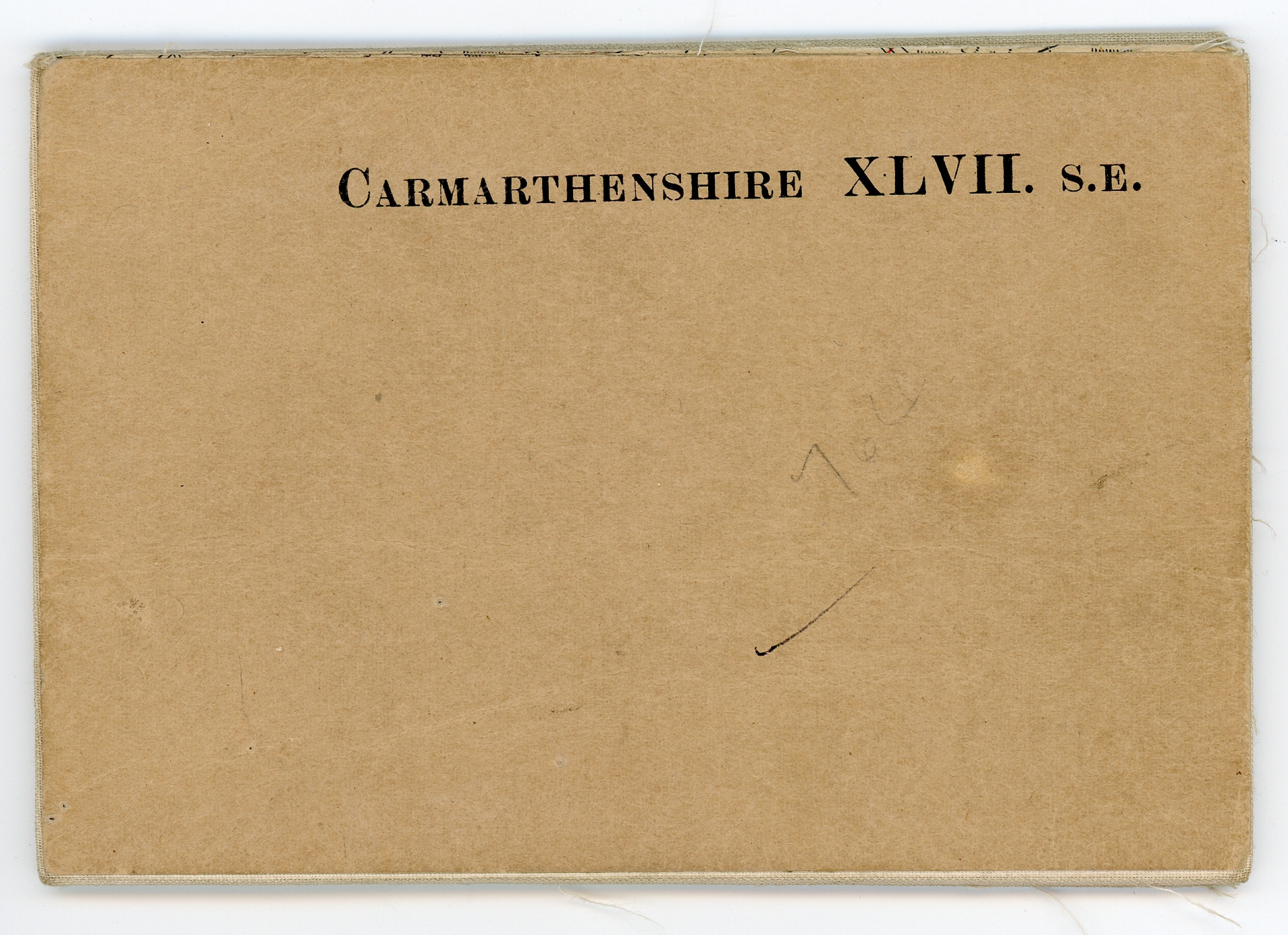
- [b] 152x99mm. E&W 3SSO Exeter emarginate c.1909.
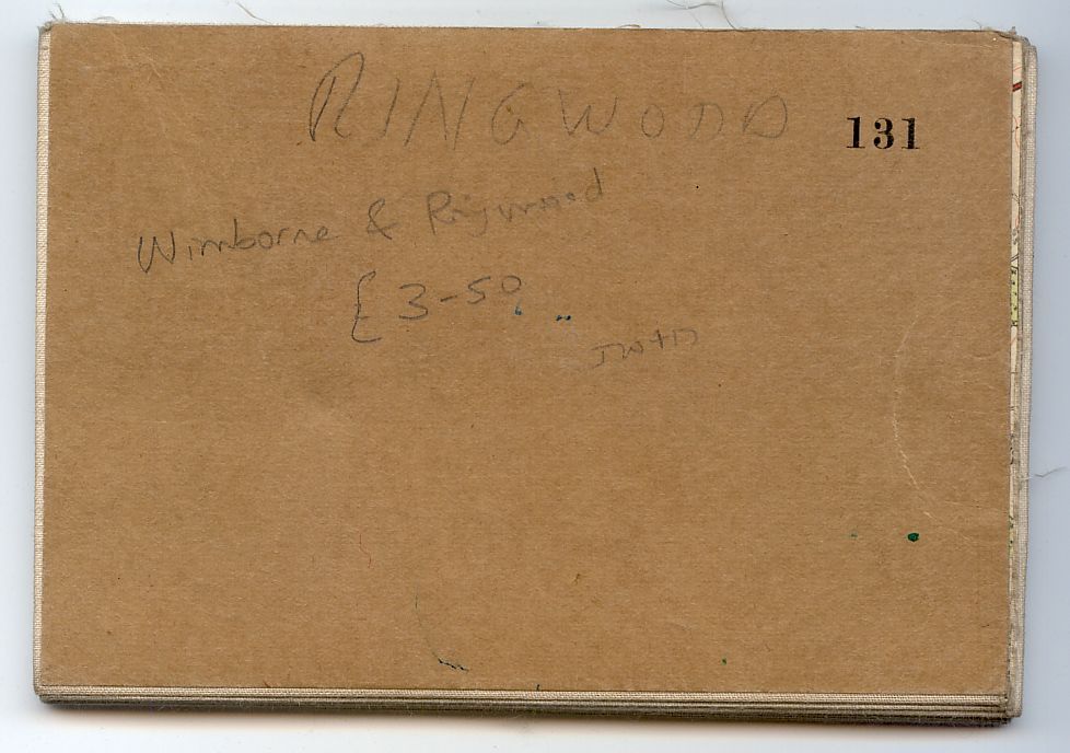
- [c] 149x102mm. E&W Popular coloured. Wimborne & Ringwood emarginate c.1937. The same style with just a sheet number is also recorded on some Scottish 1" emarginate 2nd.Ed (?) outline maps.
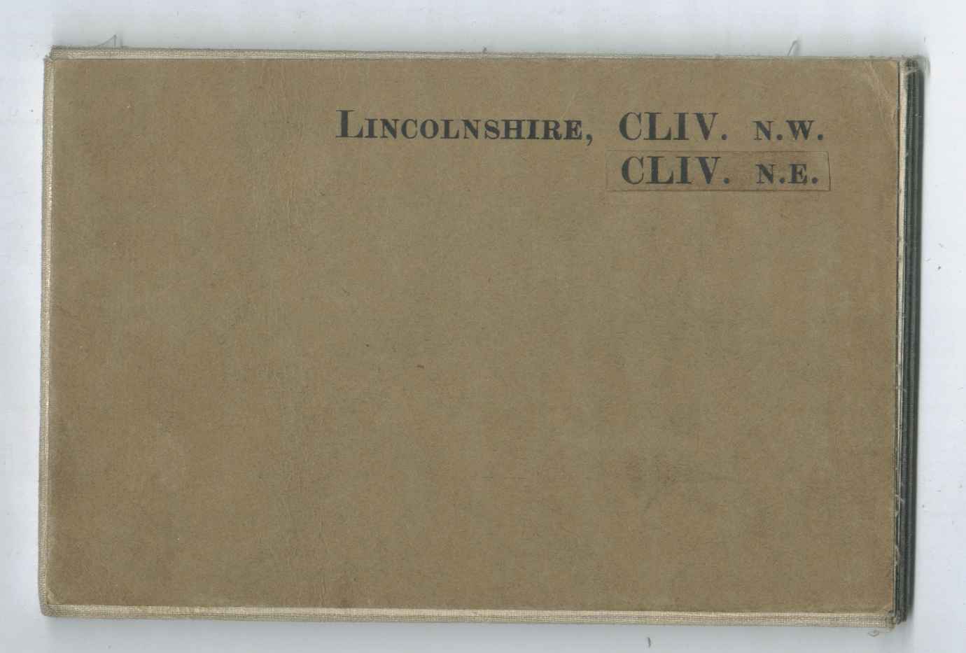
- [d] 154x100mm. Two Emarginate 6" sheets mounted together, a trimmed legend pasted to the reverse 130/36. Note CLIV.N.E. by adhesive label.
- [e] 152x102mm. 30/44.
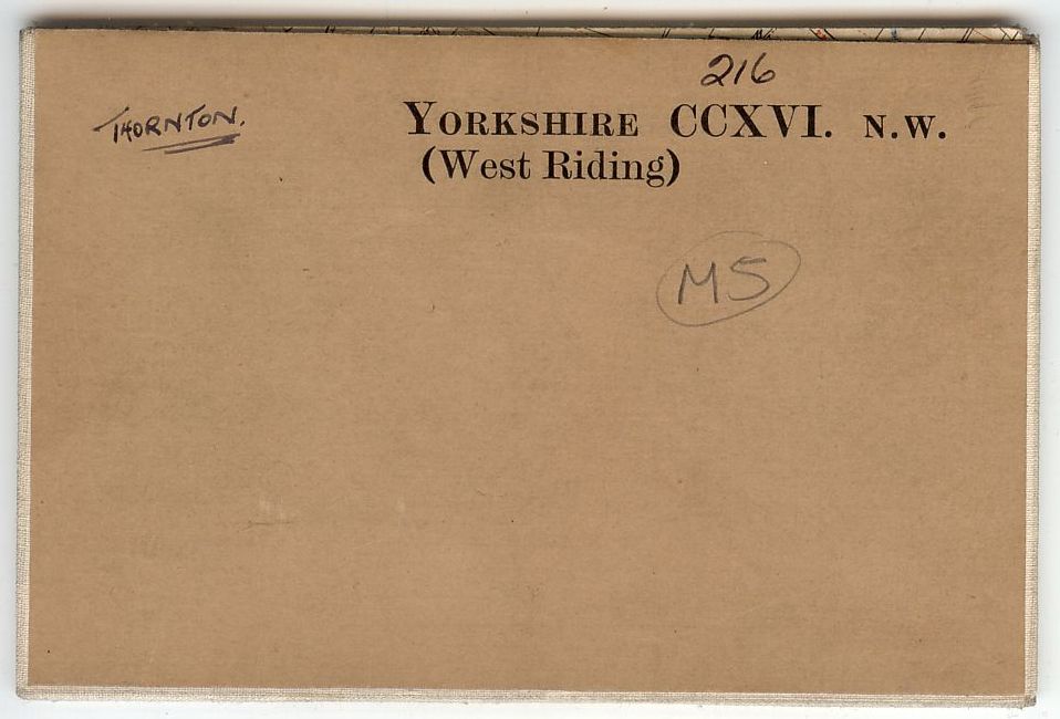
- [f] 152x100mm. Emarginate. "(West Riding)".
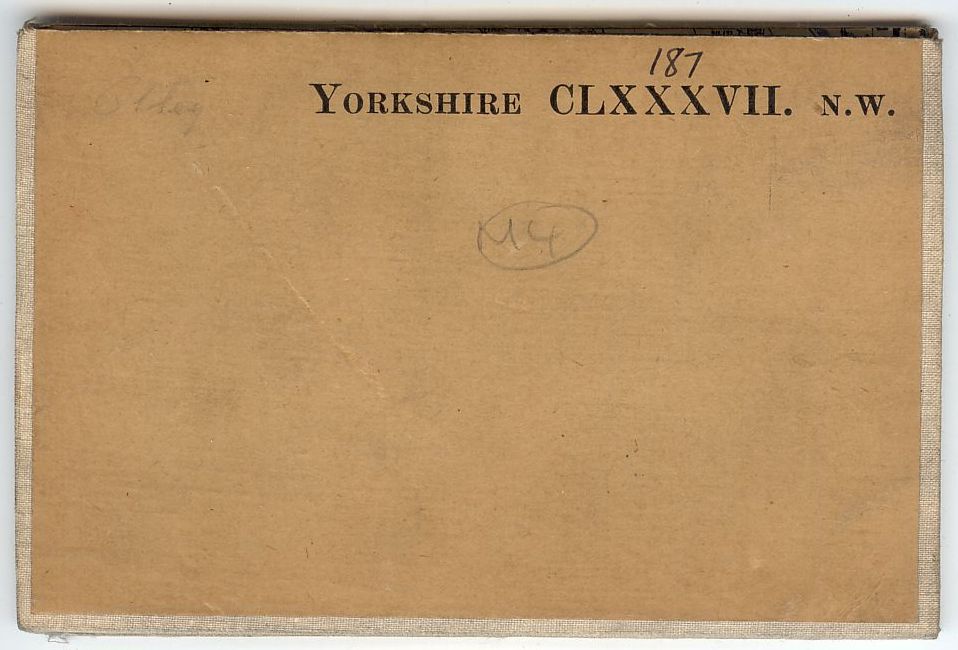
- [g] 150x99mm. Emarginate. Adjacent but no "(WR)"
221 Buff adhesive with royal arms.
221.1 With arms of GviR.
- [a] 202x98mm Emarginate.(map first issued 8/49.)
- [b] As [a] but with larger typeface.(map first issued 10/53.)
-Wide-Landscape--a.jpg)
-Wide-Landscape--b.jpg)
221.2 With arms of EiiR.
- [a][b] 158x117mm Emarginate.
- [c] 136x205mm A 1956.
- [d] 202x98mm Emarginate.(map first issued 7/48.)Note sheet reference is Alfa-Numerical only (see 221.1.[a][b])
- [e] 242x164mm. 1954. Emarginate but relevant info pasted onto reverse of map.
- [f] 120x215mm Adhesive. A//* 1964. Note brown paper with watermark lines.
- [g] 159x118mm Adhesive. Emarginate. Paper as [f].


230 White Benderfold with map title.
230.1 With map title only. For military use (?)
[a] 128x213mm. 1" 7th B//**. M722. Edition 5-GSGS . 3/69/7374/OS

230.2 "Experimental" maps enlarged from imperial to metric scales.
[a] 132x224mm 1970. Enlargement of 7th.Series map resulting in First Series 1;50,000 in 1974.
[b] 134x226mm 1970. As above. Sheet 47 is also recorded.
[c] 127x213mm 1/2" National Grid Series 1962. Map headed "Sample copy-market research only"(printed 1970)
[d] 127x196mm B/* 1968. Map headed "1:75,000 (METRIC)" and probably printed in 1970.


233. Great Britain index diagram, mauve. Geological Survey Ten Mile Map (1:625,000). Both published by IGS (now BGS)
1. Both sheets highlighted, First Edition (Quaternary), 1977
[a] 126x212mm 20000/77 (See also 256. Geology.)
[b] 126x212mm 20000/77


2. Relevant sheet highlighted Third Edition (Solid), 1979
[a] 133x226mm C 50000/79 Note IGS price label.
[b] 133x226mm C 45000/79 Note BGS title label.


234 Arms of Borough of Islwyn.
107x171mm A 1984.

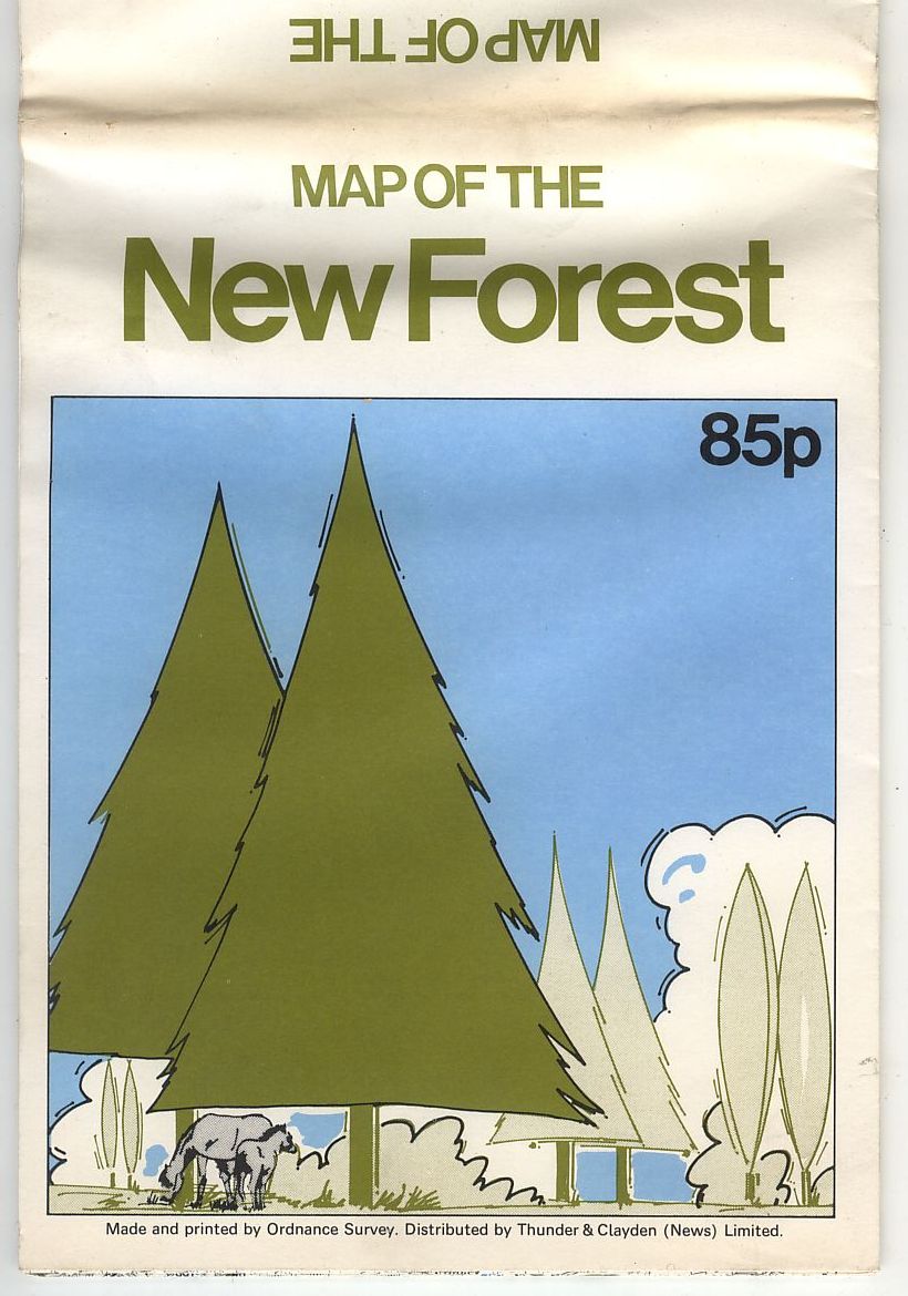
235 Fir trees and ponies. Design by Ian Halford.
132x176mm 1980. Outline map "compiled from Seventh Series sheets" with khaki New Forest boundary.
236 Orange panels
125x250mm Undated but post 1971. "Printed by the Ordnance Survey" another copy with stronger orange and price 90p "based on the Ordnance Survey".

237 Fox & Sons.
178x157mm A 1979. Double sided outline map. (See 402.3)

238 Time Capsule Monklands.
122x157mm B 1991. (See also 173.)
